Franklin in Williamson County, Tennessee — The American South (East South Central)
Attack On The Union Left / Lot No. 1 in the Plan of Carnton
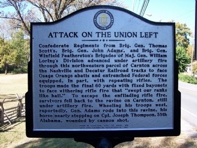
Attack On The Union Left
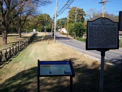
Confederate Regiments from Brig. Gen. Thomas Scott's, Brig. Gen. John Adams', and Brig. Gen. Winfield Featherstons's Brigades of Maj. Gen. William Loring's Division advanced under artillery fire through this northwestern parcel of Carnton across the Nashville and Decatur Railroad tracks to face Osage Orange abatis and entrenched Federal Forces equipped, in part, with repeating rifles. The troops made the final 60 yards with fixed bayonets to face withering rifle fire that "swept our ranks like hail." To escape the enfilading rifle fire, survivors fell back to the ravine on Carnton, still under artillery fire. Wheeling his troops west, reportedly, Gen.Adams rode into this ravine, his horse nearly stepping on Cpl. Joseph Thompson, 35th Alabama, wounded by cannon shot.
(reverse)
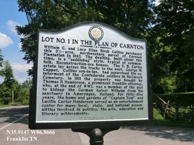
Lot No. 1 in the Plan of Carnton
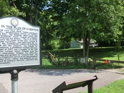
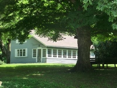
William C. and Lucy Ellen Birch Collins purchased this 3½-acre, northwestern parcel of Carnton Plantation in 1867. The dwelling, built about this time, is a “saddlebag” style, typical of common folk, Reconstruction-era houses. The F.B. Carter estate lay across the tracks to the west. George W Cuppet, Collins’ son-in-law, had supervised the reinternment of the Confederate soldiers in McGavock Cemetery. In 1911 the property was bought by Thomas P. Henderson, a prominent Franklin attorney, who, at the end of WWI, was a member of the plot to kidnap the German Kaiser Wilhelm from his sanctuary in Amerongen, Holland. For fifty-five years, the home and gardens of “Captain Tom” and Lucille Carter Henderson served as an entertainment center for many local, state, and national personalities involved in politics, the arts, education, and literary achievements.
Erected by Williamson County Historical Society, John M. Carlson, LTD, St. Paul MN, and Save the Franklin Battlefield, Inc.
Topics and series. This historical marker is listed in these topic lists: War, US Civil • War, World I. In addition, it is included in the Tennessee – Williamson County Historical Society series list. A significant historical year for this entry is 1867.
Location. 35° 54.886′ N, 86° 51.987′ W. Marker is in Franklin, Tennessee, in Williamson County. Marker is at the intersection of Lewisburg Avenue (U.S. 431) and Thompson Alley, on the left when traveling south on Lewisburg Avenue. Touch for map. Marker is in this post office area: Franklin TN 37064, United States of America. Touch for directions.
Other nearby markers. At least 8 other markers are within walking distance of this marker. Attack on the Union Left (here, next to this marker); Mills - Jewell House (approx. 0.2 miles away); Dr. James A. & Eliza B. North House (approx. 0.2 miles away); 209 Lewisburg Avenue (approx. 0.2 miles away); The Carrick North House (approx. 0.2 miles away); Willow Plunge (approx. 0.2 miles away); 204 Lewisburg Avenue (approx. 0.2 miles away); The Carter Farm (approx. 0.3 miles away). Touch for a list and map of all markers in Franklin.
Credits. This page was last revised on June 16, 2016. It was originally submitted on February 5, 2011, by Michael Dover of Ellerslie, Georgia. This page has been viewed 1,013 times since then and 7 times this year. Photos: 1. submitted on February 5, 2011, by Michael Dover of Ellerslie, Georgia. 2. submitted on October 5, 2013, by Don Morfe of Baltimore, Maryland. 3. submitted on February 5, 2011, by Michael Dover of Ellerslie, Georgia. 4, 5. submitted on October 5, 2013, by Don Morfe of Baltimore, Maryland. • Craig Swain was the editor who published this page.
