Near Browns Valley in Yuba County, California — The American West (Pacific Coastal)
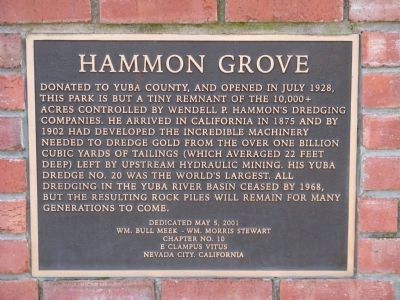
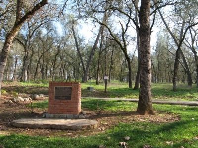
Hammon Grove
Erected 2001 by Wm. Bull Meek-Wm. Morris Stewart Chapter 10, E Clampus Vitus, Nevada City, Ca.
Topics and series. This historical marker is listed in this topic list: Industry & Commerce. In addition, it is included in the E Clampus Vitus series list. A significant historical month for this entry is July 1928.
Location. 39° 13.794′ N, 121° 23.969′ W. Marker is near Browns Valley, California, in Yuba County. Marker can be reached from Browns Valley Highway (State Highway 20) 0.8 miles east of Marysville Road, on the right when traveling east. Marker is located on the left just prior to entering the parking area of the park. Touch for map. Marker is at or near this postal address: 5321 California 20, Browns Valley CA 95918, United States of America. Touch for directions.
Other nearby markers. At least 8 other markers are within 6 miles of this marker, measured as the crow flies. Browns Valley: 1850 – 1860 (approx. 0.9 miles away); Brown's Valley: Beginnings (approx. 0.9 miles away); Donnebrouge Mine (approx. one mile away); The Yuba River Bridge at Parks Bar (approx. 3.6 miles away); Sucker Flat (approx. 5˝ miles away); Smartville / Smartsville (approx. 5.7 miles away); Smartsville Grocery (approx. 5.7 miles away); Church of the Immaculate Conception (approx. 5.7 miles away). Touch for a list and map of all markers in Browns Valley.
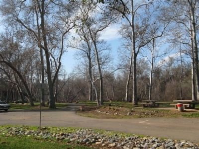
Regarding Hammon Grove. From the Yuba County Website: “Nestled at the base of the Sierra foothills where Dry Creek meets the Yuba River, Hammon Grove Park offers a glimpse into the rich past of Yuba County’s gold mining legacy. Encompassing just over 40 acres, Hammon Grove sits where Long Bar - a town long since buried under layers of hydraulic mining debris - once flourished. The land, a remnant of Wendell P. Hammon’s vast dredging operation, is littered with tell-tale signs of the quartz mining operation of days past. From extensive water canals that traverse the property leading to the mine tailings brought forth from deep underground, the stories can all but be heard from the subtle evidence that the Yuba River once thrived with prospectors.”
Also see . . . Hammonton District. Western Mining History provides the history of the area and a photo of Yuba Dredge No. 17, which was similar to Dredge No. 20, and also used on the Yuba River. (Submitted on February 10, 2011.)
Additional commentary.
1. Yuba Consolidated Gold Fields
Gold dredging in California began in 1850 when a small river boat was fitted out as a dredge and gravel mining was attempted above Marysville, California on the Yuba River. The first successful gold dredge in California was built in 1898 by Biggs, Butte County resident Wendell P. Hammon, the "Dredger King," and his partner, Thomas Couch, a Montana mining businessman. This first model and those that followed consisted of a floating hull, a digging ladder, an endless chain of buckets, screening apparatus, gold-saving devices, pumps, and a stacker. The California dredge was developed from models used earlier in New Zealand and in Montana, proving to be much more efficient than earlier one-bucket attempts.
— Submitted February 10, 2011.
Credits. This page was last revised on June 16, 2016. It was originally submitted on February 10, 2011, by Syd Whittle of Mesa, Arizona. This page has been viewed 1,230 times since then and 17 times this year. Photos: 1, 2, 3. submitted on February 10, 2011, by Syd Whittle of Mesa, Arizona.


