Near Page in Coconino County, Arizona — The American Mountains (Southwest)
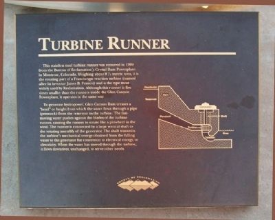
Turbine Runner
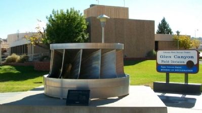
This stainless steel turbine runner was removed in 1989 from the Bureau of Reclamation's Crystal Dam Powerplant in Montrose, Colorado. Weighing about 8½ metric tons, it is the rotating part of a Francis-type reaction turbine (named after its inventor James B. Francis) and is the type most widely used by Reclamation. Although this runner is five times smaller than the runners inside the Glen Canyon Powerplant, it operates in the same way.
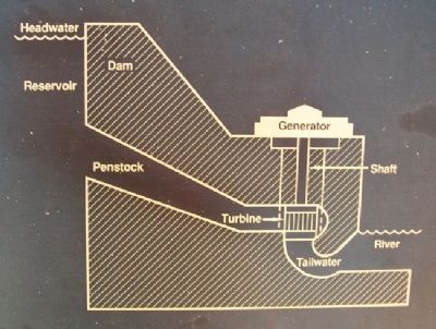
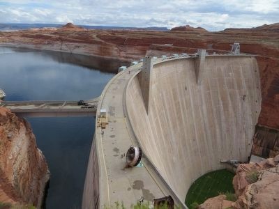
To generate hydropower, Glen Canyon Dam creates a "head" or height from which the water flows through a pipe (penstock) from the reservoir to the turbine. The fast-moving water pushes against the blades of the turbine runner, causing the runner to rotate like a pinwheel in the wind. The runner is connected by a large vertical shaft to the rotating assembly of the generator. The shaft transmits the turbine's mechanical energy obtained from the falling water to the generator for conversion to electrical energy, or electricity. When the water has moved through the turbine, it flows downriver, unchanged, to serve other needs.
Erected by Bureau of Reclamation.
Topics. This historical marker is listed in these topic lists: Charity & Public Work • Industry & Commerce • Waterways & Vessels. A significant historical year for this entry is 1989.
Location. 36° 56.164′ N, 111° 29.199′ W. Marker is near Page, Arizona, in Coconino County. Marker is west of the Glen Canyon Field Division Office/Carl Hayden Visitor Center, at Glen Canyon Dam, off U.S. Route 89, at the Colorado River. Touch for map. Marker is in this post office area: Page AZ 86040, United States of America. Touch for directions.
Other nearby markers. At least 8 other markers are within walking distance of this marker. Concrete Bucket / Concrete Core Sample (within shouting distance of this marker); Wicket Gates (within shouting distance of this marker); Bureau of Reclamation Memorial Fountain (within shouting distance of this marker); Dinosaur Tracks (about 300 feet away, measured in a direct line); Rock Bolts / High Scaling (about 300 feet away); Hydroelectric Power - A Green and Renewable Energy Source (about 300 feet away); Intake Structures (about 500 feet away); Glen Canyon Dam (about 600 feet away). Touch for a list and map of all markers in Page.
Also see . . . Glen Canyon National Recreation Area. (Submitted on February 19, 2011, by William Fischer, Jr. of Scranton, Pennsylvania.)
Credits. This page was last revised on August 16, 2020. It was originally submitted on February 19, 2011, by William Fischer, Jr. of Scranton, Pennsylvania. This page has been viewed 1,327 times since then and 11 times this year. Photos: 1, 2, 3. submitted on February 19, 2011, by William Fischer, Jr. of Scranton, Pennsylvania. 4. submitted on June 1, 2016, by Bill Kirchner of Tucson, Arizona.


