Charlotte Amalie in St. Thomas, Virgin Islands — The Caribbean (The West Indies)
St. Thomas Community Bandmaster
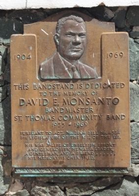
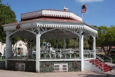
This Bandstand is Dedicated
to the memory of
David E. Monsanto
Bandmaster
St. Thomas Community Band
1935 - 1969
Pursuant to the Act. No. 2804 Bill No. 4534
8th Legislature of the V.I. of the U.S.
His was a life of unselfish effort
and generosity. He was a leader.
A gentleman, and a friend ......
His memory is cherished.
Topics. This historical marker is listed in these topic lists: African Americans • Arts, Letters, Music. A significant historical year for this entry is 1935.
Location. 18° 20.467′ N, 64° 55.814′ W. Marker is in Charlotte Amalie in St. Thomas, Virgin Islands. Marker is on Fort Strade, on the left when traveling north. Located in Emancipation Park, between Tolbad Plain and Veterans Drive. Touch for map. Marker is in this post office area: St Thomas VI 00801, United States of America. Touch for directions.
Other nearby markers. At least 8 other markers are within walking distance of this marker. America's First Lady Addressed the People of St. Thomas (here, next to this marker); Landing of Virginia Settlers (within shouting distance of this marker); St. Thomas' Liberty Bell Reproduction: (within shouting distance of this marker); Fort Christian (within shouting distance of this marker); The Jacob H. S. Lind House (within shouting distance of this marker); Frederick Lutheran Church (within shouting distance of this marker); Capitol Building (about 500 feet away, measured in a direct line); Frederick Lutheran Church Parsonage (about 500 feet away). Touch for a list and map of all markers in Charlotte Amalie.
Credits. This page was last revised on December 24, 2019. It was originally submitted on February 22, 2011, by Mike Stroud of Bluffton, South Carolina. This page has been viewed 706 times since then and 9 times this year. Photos: 1, 2. submitted on February 25, 2011, by Mike Stroud of Bluffton, South Carolina.

