Marker Logo HMdb.org THE HISTORICAL
MARKER DATABASE
“Bite-Size Bits of Local, National, and Global History”
Near Adairsville in Bartow County, Georgia — The American South (South Atlantic)
 

McPherson’s Troops March to Barnsley’s


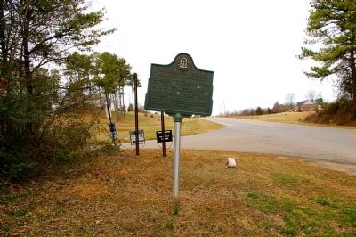
McPherson’s Troops March to Barnsley’s Marker image. Click for full size.
Photographed By David Seibert, February 19, 2011
1. McPherson’s Troops March to Barnsley’s Marker
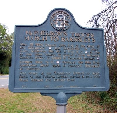
Inscription. May 18th, 1864. Logan’s 15th A.C. of the Army of the Tennessee [US] left Adairsville in afternoon, following the 4th & 14th A.C. [US] as far as this point, where it turned S.W. to Barnsley Gardens, where it joined K. Garrard’s Cavalry [US].

Dodge’s 16th A.C. [US] followed the 15th from Adairsville after dark, & reached Barnsley’s at midnight.

The Army of the Tennessee formed the right flank of the Federal Armies moving S. on a wide front toward the Etowah River.
 
Erected 1956 by Georgia Historical Commission. (Marker Number 008-29.)
 
Topics and series. This historical marker is listed in this topic list: War, US Civil. In addition, it is included in the Georgia Historical Society series list. A significant historical date for this entry is May 18, 1861.
 
Location. 34° 20.7′ N, 84° 56.3′ W. Marker is near Adairsville, Georgia, in Bartow County. Marker is at the intersection of Hall Station Road and Rock Fence Road, on the right when traveling south on Hall Station Road. Touch for map. Marker is in this post office area: Adairsville GA 30103, United States of America. Touch for directions.
 
Other nearby markers. At least 8 other markers are within 3 miles of this marker, measured as the crow flies. The Great Locomotive Chase (approx. 1.6 miles away); Adairsville, Georgia (approx. 1.6 miles away); Joe P. Bowdoin, M.D. (approx.
Paid Advertisement
Click on the ad for more information.
Please report objectionable advertising to the Editor.
Click or scan to see
this page online
1.6 miles away); Mosteller's Mills (approx. 1.7 miles away); Johnston's Army at Adairsville (approx. 1.7 miles away); Federal Armies at Adairsville (approx. 1.7 miles away); Historic Trimble House (approx. 2˝ miles away); Major John Lewis (approx. 2.7 miles away). Touch for a list and map of all markers in Adairsville.
 
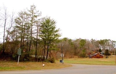
McPherson’s Troops March to Barnsley’s Marker image. Click for full size.
Photographed By David Seibert, February 19, 2011
2. McPherson’s Troops March to Barnsley’s Marker
Looking south on Hall Station Road; the 4th & 14th A.C. took this route to Kingston.
McPherson’s Troops March to Barnsley’s Marker image. Click for full size.
Photographed By David Seibert, February 19, 2011
3. McPherson’s Troops March to Barnsley’s Marker
Looking north on Hall Station Road toward Adairsville; Rock Fence Road leads to the left and to Barnsley's.
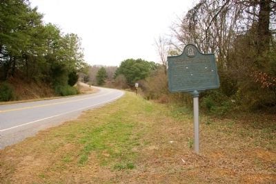
McPherson’s Troops March to Barnsley’s Marker image. Click for full size.
Photographed By David Seibert, February 19, 2011
4. McPherson’s Troops March to Barnsley’s Marker
Looking west across Hall Station Road toward Rock Fence Road, which leads to Barnsley's.
Barnsley’s Plantation House image. Click for full size.
Photographed By Brandon Fletcher, May 21, 2011
5. Barnsley’s Plantation House
Barnsley’s Plantation House image. Click for full size.
Photographed By Brandon Fletcher, May 21, 2011
6. Barnsley’s Plantation House
 
 
Credits. This page was last revised on June 16, 2016. It was originally submitted on February 22, 2011, by David Seibert of Sandy Springs, Georgia. This page has been viewed 1,195 times since then and 31 times this year. Photos:   1, 2, 3, 4. submitted on February 22, 2011, by David Seibert of Sandy Springs, Georgia.   5, 6. submitted on August 11, 2015, by Brandon Fletcher of Chattanooga, Tennessee. • Craig Swain was the editor who published this page.
Share this page.  
Share on Tumblr
m=40466

CeraNet Cloud Computing sponsors the Historical Marker Database.
This website earns income from purchases you make after using our links to Amazon.com. We appreciate your support.
Paid Advertisement
Apr. 25, 2024