Near Panguitch in Garfield County, Utah — The American Mountains (Southwest)
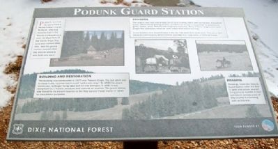
Podunk Guard Station
Podunk received its name from a Paiute Indian named Po Dunk, who had become lost in the heavily timbered area near the East Fork of the Sevier River. The area was named after him, and the guard station named after the area in which it was built and used.
Building and Restoration
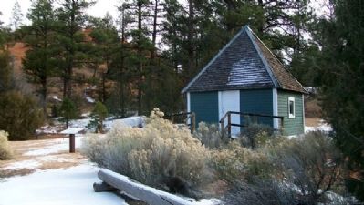
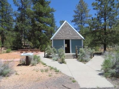
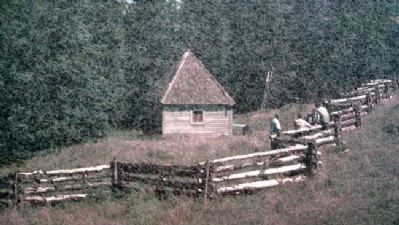
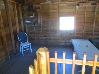
This building was constructed in 1927 near Podunk Creek. The roof pitch was so steep it was claimed that it could "split a rain drop." By 1950 the guard station was no longer being used and fell into disrepair. In 1987 it was recognized as a historic structure and restored on location. The guard station was moved to its present location at the Red Canyon Visitor Center in 1999 for educational purposes.
Rangers
The rangers that lived and worked out of back country cabins such as this one, mapped the forest, administered grazing permits, provided trail access and patrolled for poachers of game, timber, water, mineral and rangeland resources. Many of these rangers were local people that possessed hands-on skills rather than formal training.
Guard stations were located about a one day ride apart from each other. This was to give adequate back-country administrative coverage over large areas of National Forest.
Imagine
Please go inside the Podunk Guard Station when the door is open and picture yourself living several months of your summer in remote areas of this country in a building such as this one.
Erected by Dixie National Forest and Dixie Interpretive Association.
Topics. This historical marker is listed in these topic lists: Environment • Horticulture & Forestry • Man-Made Features. A significant historical year for this entry is 1927.
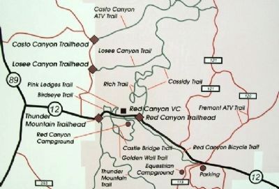
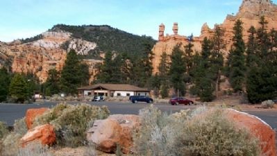
Location. 37° 44.712′ N, 112° 19.091′ W. Marker is near Panguitch, Utah, in Garfield County. Marker is at the east end of the Red Canyon Visitor Center parking lot, off Utah Route 12, in Dixie National Forest. Touch for map. Marker is in this post office area: Panguitch UT 84759, United States of America. Touch for directions.
Other nearby markers. At least 8 other markers are within 9 miles of this marker, measured as the crow flies. Red Canyon Tunnels (approx. 1.1 miles away); Butch Cassidy (approx. 1.3 miles away); A Little Panguitch History (approx. 8.2 miles away); The Panguitch Quilt Walk (approx. 8.2 miles away); Panguitch Fort (approx. 8.2 miles away); Panguitch Stake Tabernacle (approx. 8.3 miles away); Panguitch Tithing Lot (approx. 8.3 miles away); The Panguitch Quilt Walk History (approx. 8.3 miles away). Touch for a list and map of all markers in Panguitch.
Also see . . . Dixie National Forest. (Submitted on February 25, 2011, by William Fischer, Jr. of Scranton, Pennsylvania.)
Credits. This page was last revised on June 16, 2016. It was originally submitted on February 24, 2011, by William Fischer, Jr. of Scranton, Pennsylvania. This page has been viewed 1,070 times since then and 15 times this year. Photos: 1, 2. submitted on February 25, 2011, by William Fischer, Jr. of Scranton, Pennsylvania. 3. submitted on June 24, 2014, by Bill Kirchner of Tucson, Arizona. 4. submitted on February 25, 2011, by William Fischer, Jr. of Scranton, Pennsylvania. 5. submitted on June 24, 2014, by Bill Kirchner of Tucson, Arizona. 6, 7. submitted on February 25, 2011, by William Fischer, Jr. of Scranton, Pennsylvania.
