Rumsey in Yolo County, California — The American West (Pacific Coastal)
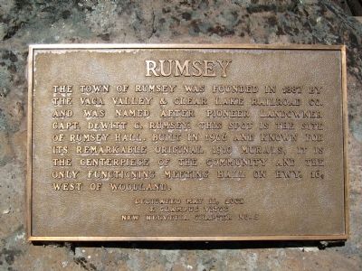
Rumsey
E Clampus Vitus
New Helvetia Chapter No. 5
Erected 2002 by E Clampus Vitus, New Helvetia Chapter No. 5.
Topics and series. This historical marker is listed in this topic list: Settlements & Settlers. In addition, it is included in the E Clampus Vitus series list. A significant historical date for this entry is May 11, 2002.
Location. 38° 53.296′ N, 122° 14.248′ W. Marker is in Rumsey, California, in Yolo County. Marker is at the intersection of Manzanita Street and California Highway 16, on the right when traveling north on Manzanita Street. Touch for map. Marker is in this post office area: Rumsey CA 95679, United States of America. Touch for directions.
Other nearby markers. At least 3 other markers are within 17 miles of this marker, measured as the crow flies. Arbuckle (approx. 13.2 miles away); The Capay-Langville School (approx. 16.2 miles away); Capay Cemetery (approx. 17 miles away).
Also see . . .
1. Rumsey, California. Wikipedia entry (Submitted on January 30, 2021, by Larry Gertner of New York, New York.)
2. The Rumsey Town Hall - Mission and History. Rumsey Improvement Association website (Submitted on January 30, 2021, by Larry Gertner of New York, New York.)

Photographed By Andrew Ruppenstein, February 26, 2011
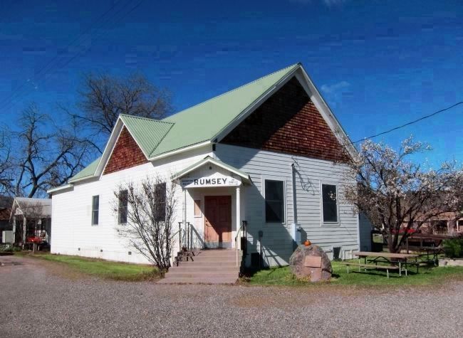
3. Rumsey Hall (1903) and marker (on the rock to the right of the entrance)
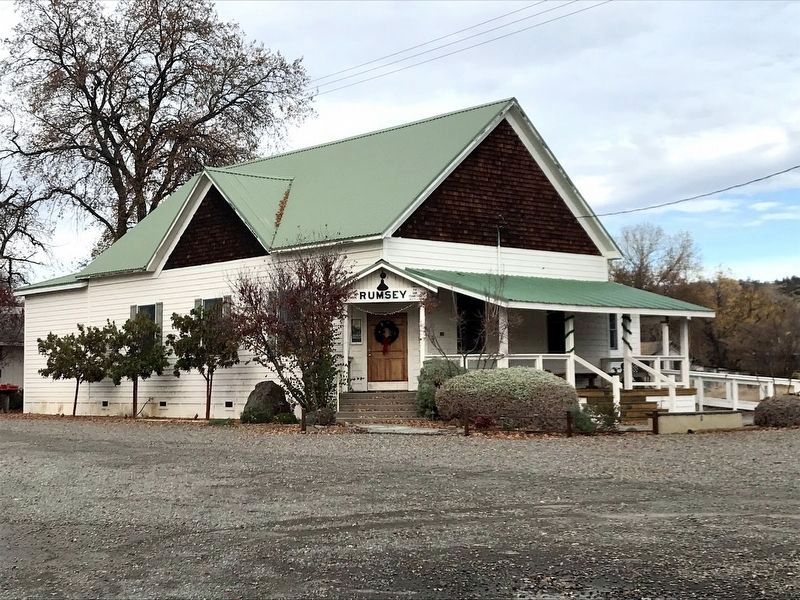
The sign above the entrance (from the old Rumsey rail depot) indicates that Rumsey is 425 feet above sea level, and 110.4 miles to San Francisco. Rumsey Hall was placed on the National Register of Historic Places in 1972, and was restored by the Rumsey Improvement Association over 1995-2008. Rumsey has a population of approximately 50 persons.
Credits. This page was last revised on January 30, 2021. It was originally submitted on February 27, 2011, by Andrew Ruppenstein of Lamorinda, California. This page has been viewed 789 times since then and 35 times this year. Photos: 1. submitted on February 27, 2011, by Andrew Ruppenstein of Lamorinda, California. 2. submitted on December 12, 2020, by Diane Phillips of Pittsburg, California. 3. submitted on February 27, 2011, by Andrew Ruppenstein of Lamorinda, California. 4. submitted on January 30, 2021, by Larry Gertner of New York, New York. • Syd Whittle was the editor who published this page.


