Near Manassas in Prince William County, Virginia — The American South (Mid-Atlantic)
Second Brigade
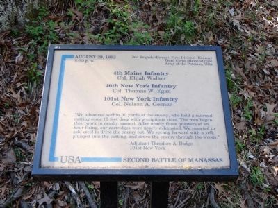
Second Battle of Manassas
5:30 p.m.
2nd Brigade (Birney), First Division (Kearny)
Third Corps (Heintzelman),
Army of the Potomac, USA
4th Maine Infantry
Col. Elijah Walker
40th New York Infantry
Col. Thomas W. Egan
101st New York Infantry
Col. Nelson A. Gesner
“We advanced within 30 yards of the enemy, who held a railroad cutting some 15 feet deep with precipitous sides. The men began their work in deadly earnest. After nearly three quarters of an hour firing, our cartridges were nearly exhausted. We resorted to cold steel to drive the enemy out. We sprang forward with a yell, plunged into the cutting, and drove the enemy through the woods.”
- Adjutant Theodore A. Dodge
101st New York
Topics. This historical marker is listed in this topic list: War, US Civil. A significant historical year for this entry is 1862.
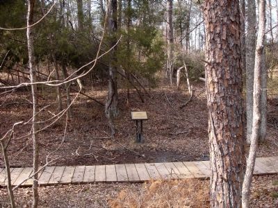
Location. 38° 49.971′ N, 77° 32.444′ W. Marker is near Manassas, Virginia, in Prince William County. Marker can be reached from Featherbed Lane (County Route 622). Located on the Unfinished Railroad Loop Trail, along the old railroad bed, in Manassas National Battlefield Park. Touch for map. Marker is in this post office area: Manassas VA 20109, United States of America. Touch for directions.
Other nearby markers. At least 8 other markers are within walking distance of this marker. Gregg’s Brigade (within shouting distance of this marker); 49th Georgia Infantry (about 600 feet away, measured in a direct line); 1st Massachusetts Infantry (approx. 0.2 miles away); Grover’s Attack ▪ Union Bayonet Charge (approx. ¼ mile away); 45th Georgia Infantry (approx. 0.3 miles away); 2nd New Hampshire Infantry (approx. 0.4 miles away); 63rd Pennsylvania Infantry (approx. 0.4 miles away); “The Unfinished Railroad” (approx. 0.4 miles away). Touch for a list and map of all markers in Manassas.
Also see . . .
1. Battle Report of Col. Elijah Walker, Fourth Maine Infantry. From Official Records of the Union and Confederate Armies. (Submitted on February 27, 2011.)
2. Battle Report of Lieut. Col. Nelson A. Gesner, 101st New York Infantry. From Official Records of the Union and Confederate Armies. (Submitted on February 27, 2011.)
Credits. This page was last revised on April 16, 2017. It was originally submitted on February 27, 2011. This page has been viewed 752 times since then and 8 times this year. Photos: 1, 2, 3. submitted on February 27, 2011. • Craig Swain was the editor who published this page.


