Bryce Canyon National Park in Garfield County, Utah — The American Mountains (Southwest)
Streetscape
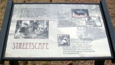
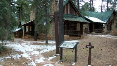
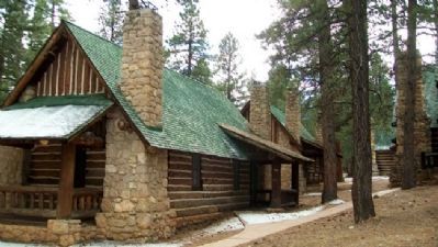
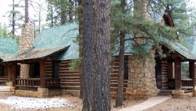
In the early 1920s, the Union Pacific Railroad, the National Park Service and the National Forest Service worked together to develop Bryce Canyon as a national park. This collection of cabins and the Bryce Canyon Lodge are a product of that partnership.
Bryce Canyon was relatively unknown before 1917. Roads and lodging were vitually non-existent. Union Pacific Railroad commissioned architect Gilbert Stanley Underwood to work with landscape architect Daniel P. Hull on designing these cabins that were convenient accommodations for tourists.
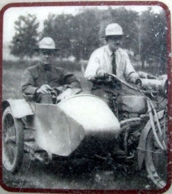
At that time, the National Park Service was striving to become the national system that it is today. The first director, Stephen Mather, pictured in the sidecar, helped launch the agency towards that goal. Like walking back in time, this streetscape provides insight into the accomplishment.
Erected by National Park Service.
Topics. This historical marker is listed in this topic list: Notable Buildings. A significant historical year for this entry is 1917.
Location. 37° 37.569′ N, 112° 10.061′ W. Marker is in Bryce Canyon National Park, Utah, in Garfield County. Marker is on a park road about 300 feet south of the Bryce Canyon Lodge. Touch for map. Marker is in this post office area: Bryce UT 84764, United States of America. Touch for directions.
Other nearby markers. At least 8 other markers are within 7 miles of this marker, measured as the crow flies. Bryce Canyon Lodge (about 400 feet away, measured in a direct line); Post-War Service Station (approx. 0.2 miles away); Wheeling through the Years (approx. 0.2 miles away); Bryce Amphitheater (approx. ¼ mile away); Stephen Tyng Mather (approx. one mile away); Tropic Pioneers (approx. 4½ miles away); Bryce Airport (approx. 4.8 miles away); Loseeville (approx. 6.6 miles away). Touch for a list and map of all markers in Bryce Canyon National Park.
Also see . . . Bryce Canyon National Park. (Submitted on February 27, 2011, by William Fischer, Jr. of Scranton, Pennsylvania.)
Credits. This page was last revised on August 29, 2020. It was originally submitted on February 27, 2011, by William Fischer, Jr. of Scranton, Pennsylvania. This page has been viewed 703 times since then and 12 times this year. Photos: 1, 2, 3, 4, 5, 6, 7. submitted on February 27, 2011, by William Fischer, Jr. of Scranton, Pennsylvania.
