Fort George Island near Jacksonville in Duval County, Florida — The American South (South Atlantic)
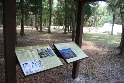
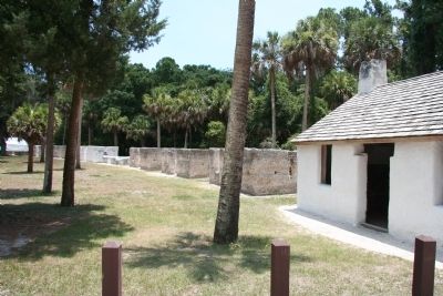
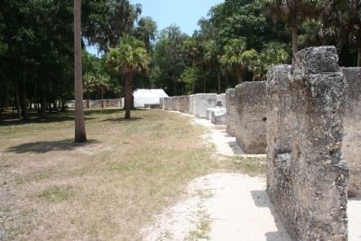
Slave Cabins
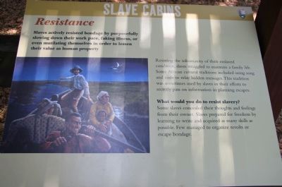
Resistance
Resisting the inhumanity of their enslaved condition, slaves struggled to maintain a family life. Some African cultural traditions included using song and code to relay hidden messages. This tradition was sometimes used by slaves in their efforts to secretly pass on information in planning escapes.
What would you do to resist slavery?
Some slaves concealed their thoughts and feelings from their owner. Slaves prepared for freedom by learning to write and acquired as many skills as possible. Few managed to organize revolts or escape bondage.
Erected by National Park Service.
Topics. This historical marker is listed in these topic lists: African Americans • Settlements & Settlers.
Location. 30° 26.209′ N, 81° 26.255′ W. Marker is near Jacksonville, Florida, in Duval County. It is on Fort George Island. Marker is on Palmetto Avenue, 2.1 miles north of Fort George Road, on the right when traveling north. This historical marker is located in a national park. The historical marker is in a very remote area that is reached by traveling a considerable distance on an unpaved dirt road. To get there one must turn north, off of the Florida State Route 1A (Heckscher Road), onto Fort George Road, and then traveling about 0.6 miles to the intersection of Fort George Road and Palmetto Avenue, were you turn north on Palmetto Avenue and travel to the end of this road to reach the historical marker. The turn-off from state route 1A can be identified by the "Kingsley Plantation, Fort George Island Visitor Center" sign that is situated right at the turnoff point. Touch for map. Marker is in this post office area: Jacksonville FL 32226, United States of America. Touch for directions.
Other nearby markers. At least 8 other markers are within walking distance of this marker. A different marker also named Slave Cabins (here, next to this marker); a different marker also named Slave Cabins (a few steps from this marker); a different marker also named Slave Cabins (a few steps from this marker); a different marker also named Slave Cabins (within shouting distance of this marker); a different marker also named Slave Cabins (within shouting distance of this marker); African Identity (about 300 feet away, measured in a direct line); a different marker also named African Identity (about 300 feet away); Slaves Cabins (about 600 feet away). Touch for a list and map of all markers in Jacksonville.
Also see . . .
1. Kingsley Plantation. This is a link to information
provided by the National Park Service. (Submitted on March 5, 2011, by Dale K. Benington of Toledo, Ohio.)
2. Kingsley Plantation. This is a link to information provided by Wikipedia, the free encyclopedia. (Submitted on March 5, 2011, by Dale K. Benington of Toledo, Ohio.)
Credits. This page was last revised on February 3, 2023. It was originally submitted on March 4, 2011, by Dale K. Benington of Toledo, Ohio. This page has been viewed 788 times since then and 12 times this year. Photos: 1, 2, 3, 4. submitted on March 5, 2011, by Dale K. Benington of Toledo, Ohio.


