North End in Boston in Suffolk County, Massachusetts — The American Northeast (New England)
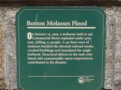
Boston Molasses Flood
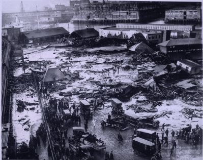
On January 15, 1919, a molasses tank at 529 Commercial Street exploded under pressure, killing 21 people. A 40-foot wave of molasses buckled the elevated railroad tracks, crushed buildings and inundated the neighborhood. Structural defects in the tank combined with unseasonably warm temperatures contributed to the disaster.
Erected by The Bostonian Society.
Topics. This historical marker is listed in these topic lists: Disasters • Industry & Commerce • Railroads & Streetcars. A significant historical month for this entry is January 1918.
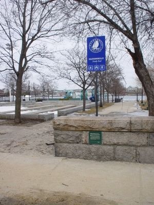
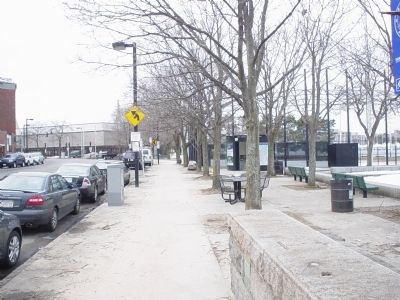
Location. 42° 22.094′ N, 71° 3.33′ W. Marker is in Boston, Massachusetts, in Suffolk County. It is in North End. Marker is on Commercial Street east of Charter Street, on the right when traveling west. This marker is located on a low granite wall. Touch for map. Marker is in this post office area: Boston MA 02109, United States of America. Touch for directions.
Other nearby markers. At least 8 other markers are within walking distance of this marker. Bocce - More than a Game (within shouting distance of this marker); The Mathers (about 300 feet away, measured in a direct line); Precious Cargo on Board (about 300 feet away); Seventeenth Century Copp’s Hill (about 300 feet away); Fresh Air and Salt Water (about 300 feet away); Unusual Gravestones (about 300 feet away); From Colonial Burying Ground to Victorian Park (about 300 feet away); African Americans at Copp’s Hill (about 300 feet away). Touch for a list and map of all markers in Boston.
More about this marker. This small marker is easy to miss while driving. There is NO parking available in this area and crossing the road to get to the marker is not advised.
Regarding Boston Molasses Flood. There are a number of interesting references regarding this event in Boston history. Songs and books abound. The book Dark Tide: The Great Boston Molasses Flood of 1919 by Stephen Puleo is a good reference.
Also see . . .
1. Molasses (words and music by Tom Rowe). Schooner Faire recorded a folk song about this Boston disaster. (Submitted on March 6, 2011, by Michael Tiernan of Danvers, Massachusetts.)
2. Boston Molasses Disaster. Wikipedia. (Submitted on March 6, 2011, by Bernard Fisher of Richmond, Virginia.)
3. The Molasses Disaster of January 15, 1919. I ran into this webpage and thought it would make a good reference for this marker. It has a discussion of the incident
itself but it also has pointers to other references about it which also make for good reading. (Submitted on October 24, 2012, by Michael Tiernan of Danvers, Massachusetts.)
Credits. This page was last revised on January 30, 2023. It was originally submitted on March 5, 2011, by Michael Tiernan of Danvers, Massachusetts. This page has been viewed 3,152 times since then and 63 times this year. It was the Marker of the Week January 13, 2013. Photos: 1, 2, 3. submitted on March 5, 2011, by Michael Tiernan of Danvers, Massachusetts. 4. submitted on March 6, 2011, by Bernard Fisher of Richmond, Virginia. • Bernard Fisher was the editor who published this page.


