Hiawatha in Minneapolis in Hennepin County, Minnesota — The American Midwest (Upper Plains)
Geology of Minnesota
Minnehaha Falls
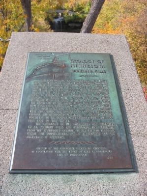
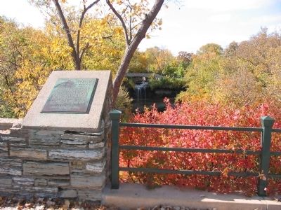
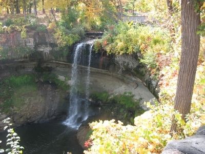
Near Fort Snelling, 10,000 years ago, melt water from the Wisconsin glacier was discharged through the Mississippi River and plunged over a ledge of Platteville limestone into a gorge cut chiefly in the white St. Peter sandstone. The undercutting action in the soft sandstone caused the limestone ledge to break off with a vertical face, thus maintaining the falls, while causing them to retreat upstream. When the falls in the main channel passed the upper end of the island–where the Soldiers Home now stands–the entire flow in the river was diverted to the main gorge and the falls in the west channel were abandoned. This unique and unusual geologic feature, an abandoned waterfall, is located at the north end of the former west channel which lies 200 feet east of this tablet.
The cataract in the Mississippi has migrated to St. Anthony Falls and Minnehaha has retreated from the abandoned channel to its present location, where the undercutting action responsible for the migration is apparent.
in cooperation with the Board of Park Commissioners
City of Minneapolis
1953
Erected 1953 by the City of Minneapolis.
Topics and series. This historical marker is listed in this topic list: Natural Features. In addition, it is included in the Minnesota: Geological Society of Minnesota series list. A significant historical year for this entry is 1953.
Location. 44° 54.92′ N, 93° 12.575′ W. Marker is in Minneapolis, Minnesota, in Hennepin County. It is in Hiawatha. Marker can be reached from South Minnehaha Park Drive near Godfrey Road. Marker is in Minnehaha Park. Touch for map. Marker is at or near this postal address: 4801 South Minnehaha Park Drive, Minneapolis MN 55417, United States of America. Touch for directions.
Other nearby markers. At least 8 other markers are within walking distance of this marker. 1–Main Entrance Minnehaha Lower Glen (within shouting distance of this marker); Gunnar Wennerberg (about 300 feet away, measured in a direct line); 3 – Master Map (about 300 feet away); President Lyndon B. Johnson (about 400 feet away); Stevens House (about 500 feet away); John Harrington Stevens House (about 500 feet away); Col. John H. Stevens (about 500 feet away); Minnehaha Depot (about 600 feet away). Touch for a list and map of all markers in Minneapolis.
Credits. This page was last revised on February 12, 2023. It was originally submitted on March 9, 2011, by Keith L of Wisconsin Rapids, Wisconsin. This page has been viewed 982 times since then and 17 times this year. Photos: 1, 2, 3, 4. submitted on March 9, 2011, by Keith L of Wisconsin Rapids, Wisconsin.


