Marker Logo HMdb.org THE HISTORICAL
MARKER DATABASE
“Bite-Size Bits of Local, National, and Global History”
Near Fredericksburg in Spotsylvania County, Virginia — The American South (Mid-Atlantic)
 

Fredericksburg Campaign


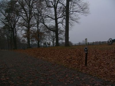
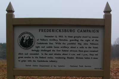
Fredericksburg Campaign Marker image. Click for full size.
Photographed By Kevin W., December 9, 2007
1. Fredericksburg Campaign Marker
Inscription. December 13, 1862. In these gunpits stood 14 cannon of Walker’s Artillery Battalion, guarding the right of the Confederate line. While the youthful Maj. John Pelham’s light and mobile horse artillery, about a mile to the front, daringly challenged the first Federal advance, these guns remained silent and concealed. In the next attacks, about 11 a.m. and 1 p.m., they cut great swaths in the Federal ranks, weakening Meade’s Division before it came to grips with the Confederate infantry.
 
Erected 1958 by United States Department of the Interior, National Park Service.
 
Topics. This historical marker is listed in these topic lists: MilitaryWar, US Civil. A significant historical date for this entry is December 13, 1862.
 
Location. This marker has been replaced by another marker nearby. 38° 14.895′ N, 77° 26.131′ W. Marker is near Fredericksburg, Virginia, in Spotsylvania County. Marker is on Lee Drive, on the left when traveling east. Marker is at the end of Lee Drive in the Fredericksburg National Military Park. Touch for map. Marker is in this post office area: Fredericksburg VA 22408, United States of America. Touch for directions.
 
Other nearby markers. At least 8 other markers are within walking distance of this location. Jackson Holds Prospect Hill (here, next to this marker); a different marker also named Fredericksburg Campaign (here, next
Paid Advertisement
Click on the ad for more information.
Please report objectionable advertising to the Editor.
Click or scan to see
this page online
to this marker); Dead Horse Hill (here, next to this marker); Jackson (here, next to this marker); Hamilton's Crossing (within shouting distance of this marker); a different marker also named Hamilton's Crossing (within shouting distance of this marker); A Southern Memorial (approx. 0.2 miles away); The Meade Pyramid (approx. 0.2 miles away). Touch for a list and map of all markers in Fredericksburg.
 
Regarding Fredericksburg Campaign. This marker was replaced by one named "Jackson Holds Prospect Hill" (See nearby markers).
 
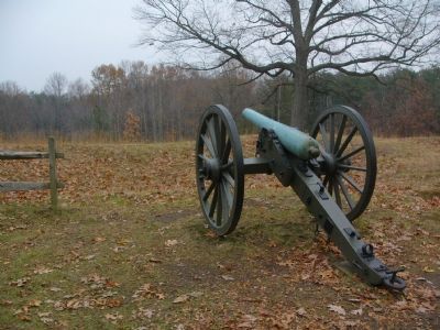
Fredericksburg Campaign Markers image. Click for full size.
Photographed By Kevin W., December 9, 2007
2. Fredericksburg Campaign Markers
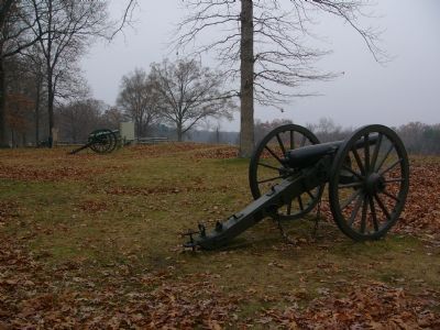
View down one of four cannons on the site. image. Click for full size.
Photographed By Kevin W., December 9, 2007
3. View down one of four cannons on the site.
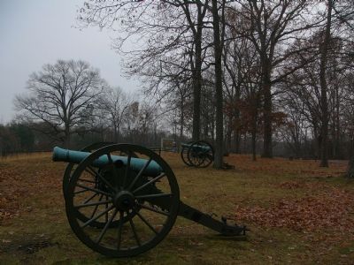
View down the gunpits, looking northwest image. Click for full size.
Photographed By Kevin W., December 9, 2007
4. View down the gunpits, looking northwest
View up the gunpits, looking southeast. image. Click for full size.
Photographed By Kevin W., December 9, 2007
5. View up the gunpits, looking southeast.
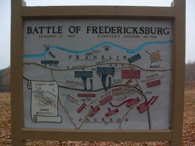
Map of the Battle image. Click for full size.
Photographed By Kevin W., December 9, 2007
6. Map of the Battle
Double click on the photo to read the narrative for the units depicted.
 
 
Credits. This page was last revised on February 2, 2023. It was originally submitted on December 10, 2007, by Kevin W. of Stafford, Virginia. This page has been viewed 1,218 times since then and 15 times this year. Photos:   1, 2, 3, 4, 5, 6. submitted on December 10, 2007, by Kevin W. of Stafford, Virginia.
Share this page.  
Share on Tumblr
m=4087

CeraNet Cloud Computing sponsors the Historical Marker Database.
This website earns income from purchases you make after using our links to Amazon.com. We appreciate your support.
Paid Advertisement
Apr. 24, 2024