Near Shiloh in Hardin County, Tennessee — The American South (East South Central)
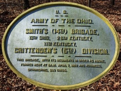
Smith's Brigade
Crittenden's Division
— Army of the Ohio —
Army of the Ohio.
Smith's (14th) Brigade.
13th Ohio, 26th Kentucky, 11th Kentucky.
Crittenden's (5th) Division.
This brigade, with its regiments in order as above, formed here at 8 a.m. April 7, 1862 and advanced, skirmishing, 500 yards.
Erected by Shiloh National Battlefield Commission. (Marker Number 272.)
Topics. This historical marker is listed in this topic list: War, US Civil. A significant historical month for this entry is April 1942.
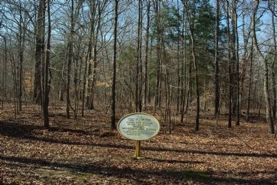
Location. 35° 8.367′ N, 88° 19.983′ W. Marker is near Shiloh, Tennessee, in Hardin County. Marker is at the intersection of Hamburg-Savannah Road and Brown's Ferry Road, on the right when traveling south on Hamburg-Savannah Road. 200 yards west of the intersection in Cloud Field. Touch for map. Marker is in this post office area: Shiloh TN 38376, United States of America. Touch for directions.
Other nearby markers. At least 8 other markers are within walking distance of this marker. Camp of 32nd Illinois Infantry (within shouting distance of this marker); 14th Iowa Infantry (within shouting distance of this marker); Chalmers' Brigade (about 300 feet away, measured in a direct line); Alabama State Memorial (about 300 feet away); Camp of 41st Illinois Infantry (about 300 feet away); 19th Alabama Monument (about 400 feet away); Jackson's Brigade (about 400 feet away); Boyle's Brigade (about 400 feet away). Touch for a list and map of all markers in Shiloh.
Credits. This page was last revised on June 16, 2016. It was originally submitted on March 24, 2011, by Allen Gathman of Pocahontas, Missouri. This page has been viewed 364 times since then and 7 times this year. Photos: 1, 2, 3. submitted on March 24, 2011, by Allen Gathman of Pocahontas, Missouri. • Craig Swain was the editor who published this page.


