Madison in Dane County, Wisconsin — The American Midwest (Great Lakes)
Madison Park & Pleasure Drive Association
Inscription.
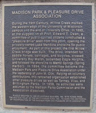
During the 19th Century, Willow Creek marked the western edge of the University of Wisconsin campus and the end of University Drive. In 1892, at the suggestion of Prof. Edward T. Owen, a committee of public-spirited citizens constructed a "pleasure drive" west from this point, opening the privately-owned Lake Mendota shoreline for public enjoyment. As part of this project, the first Willow Creek bridge was built. The drive, intended for saddle horses, carriages, and bicycles, crossed University Bay Marsh, ascended Eagle Heights, and followed the shoreline to Merrill Springs (Spring Harbor). In 1894, the committee became the Madison Park and Pleasure Drive Association under the leadership of John M. Olin. Relying on voluntary contributions, this renowned organization established other pleasure drives as well as Tenney, Vilas, and Brittingham Parks. In 1938, its activities were assumed by the Madison Parks Commission and the Association dissolved.
Erected 1995 by Historic Madison, Inc.
Topics. This historical marker is listed in these topic lists: Charity & Public Work • Roads & Vehicles. A significant historical year for this entry is 1892.
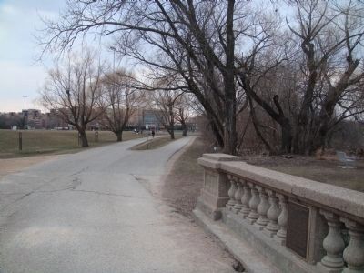
Location. 43° 4.679′ N, 89° 25.286′ W. Marker is in Madison, Wisconsin, in Dane County. Marker can be reached from Observatory Drive, 0.2 miles west of Elm Drive, on the right when traveling west. The marker is behind the Natatorium on the Willow Creek bridge part of the Lakeshore Path. Touch for map. Marker is at or near this postal address: 2000 Observatory Drive, Madison WI 53706, United States of America. Touch for directions.
Other nearby markers. At least 8 other markers are within walking distance of this marker. University Creek Group (within shouting distance of this marker); University of Wisconsin Dairy Barn (approx. ¼ mile away); Howard M. Temin (approx. 0.3 miles away); Understanding Immunity (approx. 0.3 miles away); Preventing Endemic Goiter (approx. 0.3 miles away); Revolutionizing Animal Reproduction (approx. 0.3 miles away); Discovering Vitamins and Trace Minerals (approx. 0.4 miles away); Scientific Approach to Agriculture (approx. 0.4 miles away). Touch for a list and map of all markers in Madison.
More about this marker. According to the marker, it was erected "with funds from the Madison Trust of the Brittingham Fund, Inc., to mark the Centennial of incorporation of the Madison Park and Pleasure Drive Association."
Related markers. Click here for a list of markers that are related to this marker. This is a list of markers that mention John Olin.
Credits. This page was last revised on September 6, 2021. It was originally submitted on March 31, 2011, by William J. Toman of Green Lake, Wisconsin. This page has been viewed 506 times since then and 18 times this year. Photos: 1. submitted on March 31, 2011, by William J. Toman of Green Lake, Wisconsin. 2. submitted on September 5, 2021, by McGhiever of Minneapolis, Minnesota. 3, 4. submitted on March 31, 2011, by William J. Toman of Green Lake, Wisconsin. 5. submitted on November 15, 2014.


