Taylorsville in Salt Lake County, Utah — The American Mountains (Southwest)
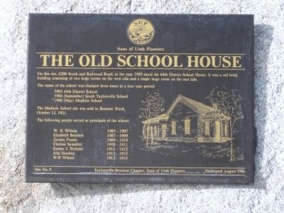
The Old School House
The name of the school was changed three times in a four year period:
1905 64th District School
1906 (September) South Taylorsville School
1908 (May) Madison School
The Madison School site was sold to Bennion Ward, October 12, 1921.
The following people served as principals of the school:
W.R. Wilson 1905-1907 • Elizabeth Bennion 1907-1909 • Zeretta Frame 1909-1910 • Clarissa Saunders 1910-1911 • Emma J. Webster 1911-1912 • Alta Stookey 1912-1913 • W.R. Wilson 1913-1915
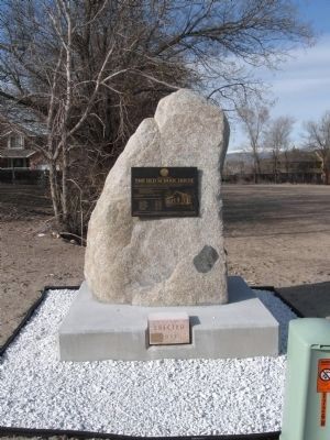
Erected 1986 by Taylorsville-Bennion Chapter, Sons of Utah Pioneers. (Marker Number 9.)
Topics and series. This historical marker is listed in these topic lists: Churches & Religion • Education. In addition, it is included in the Sons of Utah Pioneers series list. A significant historical month for this entry is October 1931.
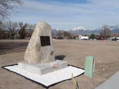
Location. 40° 38.3′ N, 111° 56.383′ W. Marker is in Taylorsville, Utah, in Salt Lake County. Marker is on 6200 South, on the right when traveling west. On the north side of 6200 South, just west of Redwood Road. Touch for map. Marker is at or near this postal address: 1725 South 6200 South, Salt Lake City UT 84118, United States of America. Touch for directions.
Other nearby markers. At least 8 other markers are within 3 miles of this marker, measured as the crow flies. Millrace (approx. 1.4 miles away); West Jordan Industry (approx. 2.2 miles away); West Jordan Settlement (approx. 2.2 miles away); Utah Idaho Sugar Factory (approx. 2.2 miles away); Salt Lake and Utah Railroad (approx. 2.2 miles away); North Jordan Canal (approx. 2.2 miles away); English Fort (approx. 2.2 miles away); West Jordan (approx. 2.2 miles away). Touch for a list and map of all markers in Taylorsville.
Regarding The Old School House. In 1921 the building was sold to the LDS Church, Bennion Ward. The old school was demolished and several different Church structures stood in its place until 2010 when UDOT (Utah Department of Transportation) purchased the corner and cleared it for road improvements.
Credits. This page was last revised on June 16, 2016. It was originally submitted on March 31, 2011, by Jack Duffy of West Jordan, Utah. This page has been viewed 1,169 times since then and 54 times this year. Photos: 1, 2, 3. submitted on March 31, 2011, by Jack Duffy of West Jordan, Utah. • Syd Whittle was the editor who published this page.


