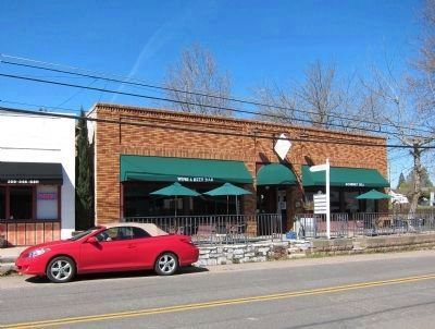
Plymouth in Amador County, California — The American West (Pacific Coastal)
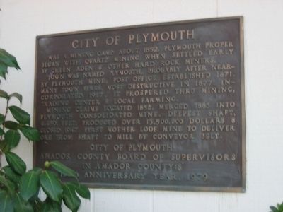
City of Plymouth
Erected 1979 by City of Plymouth, Amador County Board of Supervisors in Amador County's 125th Anniversary Year.
Topics. This historical marker is listed in these topic lists: Industry & Commerce • Notable Places • Settlements & Settlers. A significant historical year for this entry is 1852.
Location. 38° 28.873′ N, 120° 50.833′ W. Marker is in Plymouth, California, in Amador County. Marker can be reached from Main Street east of Mineral Street. Marker is located on the City Hall Building. Touch for map. Marker is at or near this postal address: 9426 Main Street, Plymouth CA 95669, United States of America. Touch for directions.
Other nearby markers. At least 8 other markers are within 3 miles of this marker, measured as the crow flies. The Arcade Bar (within shouting distance of this marker); Wheeler Building (about 300 feet away, measured in a direct line); Memorial Entrance (about 800 feet away); Chinese Store (approx. 0.3 miles away); Plymouth Consolidated Mines (approx. 0.4 miles away); Benny Brown Arena (approx. 0.4 miles away); Drytown (approx. 2.8 miles away); Salute to Early Amador Miners (approx. 2.8 miles away). Touch for a list and map of all markers in Plymouth.
Also see . . . Travel Through Time on Historic 49. (Submitted on August 18, 2008, by Syd Whittle of Mesa, Arizona.)
Photographed By Syd Whittle, November 21, 2005
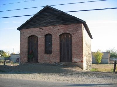
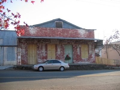
3. Plymouth Trading Post
California Registered Historical Landmark No.470
This building, constructed entirely of brick, was built by Joe Williams in 1857. In 1873 the many small mines of the area were combined to become Plymouth Consolidated, and this building became the new company's office and commissary.
March 31, 2011
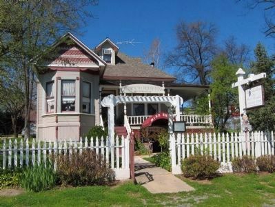
6. Plymouth House Inn - 9525 Main Street
Constructed in 1885 by Dr. E.V. Tiffany, who found gold while digging the foundation. A tunnel is supposed to run from under the house to a location across the street where a hotel once stood. The tunnel was said to have been used by "Ladies of the Night", who visited Dr. Tiffany's card games. The building is also said to have ghosts. Currently occupied by a bed and breakfast inn, as well as an antique store.
Credits. This page was last revised on June 16, 2016. It was originally submitted on August 18, 2008, by Syd Whittle of Mesa, Arizona. This page has been viewed 2,150 times since then and 51 times this year. Last updated on April 1, 2011, by Andrew Ruppenstein of Lamorinda, California. Photos: 1, 2, 3, 4, 5. submitted on August 18, 2008, by Syd Whittle of Mesa, Arizona. 6, 7. submitted on April 1, 2011.
