Munfordville in Hart County, Kentucky — The American South (East South Central)
William Boone's Grave
Side A
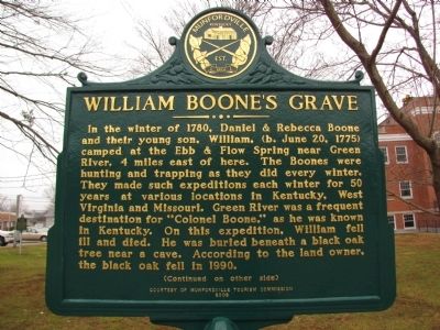
In the winter of 1780, Daniel & Rebecca Boone and their young son, William, (b. June 20, 1775) camped at the Ebb & Flow Spring near Green River, 4 miles east of here. The Boones were hunting and trapping as they did every winter for 50 years at various locations in Kentucky, West Virginia and Missouri. Green River was a frequent destination for "Colonel Boone," as he was known in Kentucky. On this expedition, William fell ill and died. He was buried beneath a black oak tree near a cave. According to the land owner, the black oak fell in 1990.
Side B
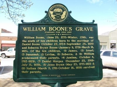
William Boone, (June 20, 1775-Winter, 1780), was the ninth of ten children born to the marriage of Daniel Boone (October 22, 1734-September 26, 1820) and Rebecca Bryan Boone (January 9, 1738-March 18, 1813). Of the ten children, (1) James, (2) Israel, (3) Susannah, (5) Levina, (6) Rebecca, & (9) William predeceased their parent. (4) Jemima, (October 4, 1762 - 1829), (7) Daniel Morgan (December 23, 1769 - July 13, 1839), (8) Jesse Bryan (May 23, 1773 - 1821) & (10) Nathan (March 3, 1781 - October 16, 1856) survived their parents.
Erected 2008 by Munfordville Tourism Commission.
Topics. This historical marker is listed in these topic lists: Cemeteries & Burial Sites
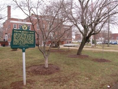
Location. 37° 16.304′ N, 85° 53.427′ W. Marker is in Munfordville, Kentucky, in Hart County. Marker is at the intersection of Main Street (U.S. 31W) and East Union Street (State Road 357), on the left when traveling south on Main Street. Marker is on the grounds of the Hart County courthouse. Touch for map. Marker is in this post office area: Munfordville KY 42765, United States of America. Touch for directions.
Other nearby markers. At least 8 other markers are within walking distance of this marker. Hart County, 1819 (a few steps from this marker); a different marker also named Hart County (within shouting distance of this marker); Henry Clay Furnace / Iron Made in Kentucky (within shouting distance of this marker); Hart County War Memorial (within shouting distance of this marker); Remembering the Sacrifices of War (within shouting distance of this marker); A Remarkable Kentucky Family (within shouting distance of this marker); William Clark and Family (within shouting distance of this marker); Munfordville in the Civil War (within shouting distance of this marker). Touch for a list and map of all markers in Munfordville.
Credits. This page was last revised on November 20, 2019. It was originally submitted on April 20, 2011, by Lee Hattabaugh of Capshaw, Alabama. This page has been viewed 1,713 times since then and 96 times this year. Photos: 1, 2, 3. submitted on April 20, 2011, by Lee Hattabaugh of Capshaw, Alabama. • Bill Pfingsten was the editor who published this page.


