Near Dunn in Cumberland County, North Carolina — The American South (South Atlantic)
Prelude to Averasboro
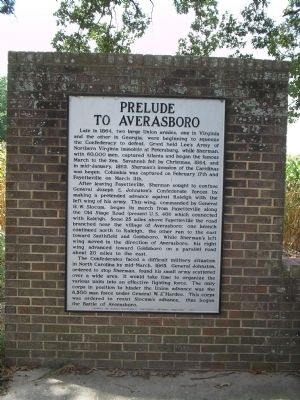
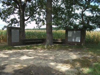
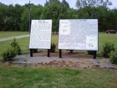
Late in 1864, two large Union armies, one in Virginia and the other in Georgia, were beginning to squeeze the Confederacy to defeat. Grant held Lee’s Army of Northern Virginia immobile at Petersburg, while Sherman, with 60,000 men, captured Atlanta and began the famous March to the Sea. Savannah fell by Christmas, 1864, and in mid-January, 1865, Sherman’s invasion of the Carolinas was begun. Columbia was captured on February 17th and Fayetteville on March 11th.
After leaving Fayetteville, Sherman sought to confuse General Joseph E. Johnston’s Confederate forces by making a pretended advance against Raleigh with the left wing of his army. This wing, commanded by General H. W. Slocum, began its march from Fayetteville along the Old Stage Road (present U.S. 401) which connected with Raleigh. Some 25 miles above Fayetteville the road branched near the village of Averasboro: one branch continued north to Raleigh, the other ran to the east towards Smithfield and Goldsboro. While Sherman’s left wing moved in the direction of Averasboro, his right wing advanced toward Goldsboro on a parallel road about 20 miles to the east.
The Confederates faced a difficult military situation in North Carolina by mid-March, 1865. General Johnston, ordered to stop Sherman, found his small army scattered over a wide area. It would take time to organize the various units into an effective fighting force. The only corps in position to hinder the Union advance was the 6,500 man force under General W.J. Hardee. This corps was ordered to resist Slocum’s advance, thus began the Battle of Averasboro.
Erected 1961 by Archives and Highway Departments. Confederate Centennial Commission.
Topics. This historical marker is listed in this topic list: War, US Civil. A significant historical month for this entry is February 1848.
Location. 35° 13.948′ N, 78° 40.717′ W. Marker is near Dunn, North Carolina, in Cumberland County. Marker is at the intersection of Burnett Road (State Highway 82) and Ross West Road, on the right when traveling south on Burnett Road. Marker is on Route 82, about 6 miles south of Dunn, NC. Touch for map. Marker is in this post office area: Dunn NC 28334, United States of America. Touch for directions.
Other nearby markers. At least 8 other markers are within 2 miles of this marker, measured as the crow flies. Federal Hospital (within shouting distance of this marker); Battle of Averasboro (within shouting distance of this marker); Federal Artillery (approx. one mile away); "Oak Grove" (approx. 1.1 miles away); David M. Williams (approx. 1.2 miles away); Confederate First Line (approx. 1.3 miles away); Taliaferro’s Division (approx. 1.3 miles away); 20th Corps (approx. 1.4 miles away). Touch for a list and map of all markers in Dunn.
Also see . . .
1. Averasboro Battlefield and Museum. Museum website homepage (Submitted on March 1, 2008, by Bill Coughlin of Woodland Park, New Jersey.)
2. Prelude to the Battle of Averasboro. North Carolina History Project website entry (Submitted on December 23, 2008, by Bill Coughlin of Woodland Park, New Jersey.)
Credits. This page was last revised on April 11, 2024. It was originally submitted on February 29, 2008, by Bill Coughlin of Woodland Park, New Jersey. This page has been viewed 1,448 times since then and 20 times this year. Last updated on April 26, 2011, by Lee Hattabaugh of Capshaw, Alabama. Photos: 1, 2. submitted on February 29, 2008, by Bill Coughlin of Woodland Park, New Jersey. 3, 4. submitted on April 26, 2011, by Lee Hattabaugh of Capshaw, Alabama. • Bill Pfingsten was the editor who published this page.


