Cadott in Chippewa County, Wisconsin — The American Midwest (Great Lakes)
Introduction to the Geology of the Cadott Region
Inscription.
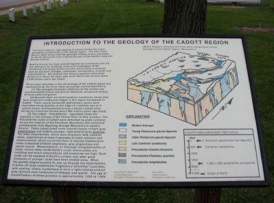
The block diagram right depicts in simple format the major geological components of the Cadott region. The time scale [below right] shows that the geologic history at any one place on Earth represents only a miniscule part of the Earth's long and diverse history.
Earth's history has been pieced together by scientists over the last 200 years by studying rocks and landscapes of the continents and ocean basins and the active Earth processes such as sea level changes, volcanism, earthquakes, erosion and sedimentation. We assume that these processes have been going on in about the same way since Earth was formed about 4,500 million years ago [mya].
Three major episodes in the chronology of the Cadott region are represented by the three major groupings summarized below.
[1] The youngest Cenozoic materials at the surface are unconsolidated stream and glacial deposits, composed mostly of loose sand and gravel.
[2] Beneath them are hard Cambrian sandstone strata that form prominent knobs and ledges in the region southwest of Cadott. These nearly horizontal sedimentary layers were deposited along beaches at the edge of a shallow sea as it spread slowly northwestward across a broad coastal plain during the Cambrian Period about 500 million years ago [mya].
[3] The oldest - Precambrian - basement rocks are exposed in the channel of the Yellow River at this location. The Precambrian rocks of Cadott were deformed by plate collision during the creation of the Penokean Mountains that streached northeasterly from Wyoming through Wisconsin to eastern Ontario. These complicated rocks consist mostly of dark gray amphibolites and slightly younger, light pinkish gray granites. The older amphibolites, which were originally dark volcanic rocks, experienced at least 2 episodes of plate collision and metamorphism which converted them to layered metamorphic rocks composed of black amphibole, gray plagioclase and sparse quartz. Metamorphism, or thorough recrystallization of rocks, occurs deep inside Earth's crust, where plates are colliding and where temperatures and pressures are high. Such rocks can be exposed at Earth's surface only after great thickness of younger rocks have been eroded away. When the granite magma pushed its way up through the amphibolites, it broke off large amphibolite fragments ["xenoliths"] and then, with cooling, slowly crystallized to form a light-colored pinkish gray igneous rock composed of feldspar and quartz. The age of crystallization of these granites is approximately 1,820 to 1,800.
Created by: Dr. Paul Myers
Geology Department
University of Wisconsin-Eau Claire
Donated by:
Cadott Economic
Development Corporation
Erected 2004 by Dr. Paul Myers; Cadott Economic Development Corporation.
Topics. This historical marker is listed in this topic list: Natural Features.
Location. Marker has been reported missing. It was located near 44° 57.216′ N, 91° 8.815′ W. Marker was in Cadott, Wisconsin, in Chippewa County. Marker was on State Highway 27, 0.1 miles north of Mills Street, on the left when traveling north. Marker is in Riverview Park along Park Place Road. Touch for map. Marker was in this post office area: Cadott WI 54727, United States of America. Touch for directions.
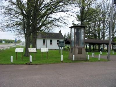
Other nearby markers. At least 8 other markers are within 2 miles of this location, measured as the crow flies. The Cadotte Fur Traders (here, next to this marker); The Great Northern Pine of Wisconsin (here, next to this marker); Cadott Centennial (here, next to this marker); Cadotte Trading Post Site (here, next to this marker); Cadott Hub and Spoke Factory (about 400 feet away, measured in a direct line); The Gravesite of Lansing A. Wilcox (approx. one mile away); Wisconsin Veterans Tribute (approx. 1.2 miles away); Citizen Soldier Monument (approx. 1.2 miles away). Touch for a list and map of all markers in Cadott.
More about this marker. A Block Diagram at the right side of the marker shows the three
main components of the geology of the Cadott region, Wisconsin. A Cadott Area Geologic Time Scale is at the lower right side of the marker.
Credits. This page was last revised on July 16, 2022. It was originally submitted on April 26, 2011, by Keith L of Wisconsin Rapids, Wisconsin. This page has been viewed 1,040 times since then and 53 times this year. Photos: 1, 2. submitted on April 26, 2011, by Keith L of Wisconsin Rapids, Wisconsin. 3. submitted on July 16, 2022, by Jim Schaettle of Madison, Wisconsin.


