Fort Dupont in Southeast Washington in Washington, District of Columbia — The American Northeast (Mid-Atlantic)
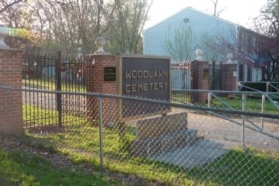
Woodlawn Cemetery
4611 Benning Road, SE
— African American Heritage Trail, Washington DC —
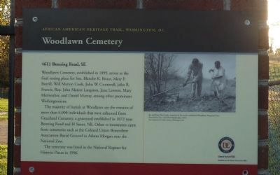
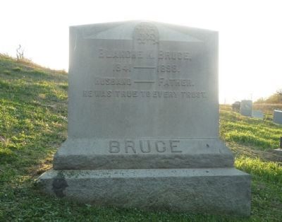
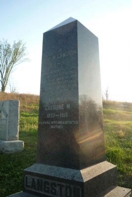
Woodlawn Cemetery, established in 1895, serves the final resting place for Sen. Blanche K. Bruce, Mary P. Burrill, Will Marion Cook, John W. Cromwell, John R. Francis, Rep. John Mercer Langston, Jesse Lawson, Mary Meriwether, and Daniel Murray, among other prominent Washingtonians.
The majority of burials at Woodlawn are the remains of more than 6,000 individuals that were exhumed from Graceland Cemetery, a graveyard established in 1872 near Benning Road and H Street, NE. Other re-interments came from cemeteries such as the Colonial Union Benevolent Association Burial Ground in Adams Morgan near the National Zoo.
The cemetery was listed in the National Register for Historic Places in 1996.
Erected by Cultural Tourism DC.
Topics and series. This historical marker is listed in these topic lists: African Americans • Cemeteries & Burial Sites. In addition, it is included in the African American Heritage Trail series list. A significant historical year for this entry is 1895.
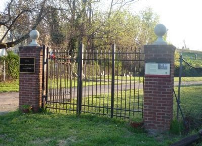
Location. 38° 53.155′ N, 76° 56.164′ W. Marker is in Southeast Washington in Washington, District of Columbia. It is in Fort Dupont. Marker is at the intersection of Benning Road Southeast and C Street Southeast, on the right when traveling south on Benning Road Southeast. Marker is on the north side of the cemetery's east gate in the Fort Dupont community in Southeast Washington. Touch for map. Marker is at or near this postal address: 4611 Benning Road Southeast, Washington DC 20019, United States of America. Touch for directions.
Other nearby markers. At least 8 other markers are within walking distance of this marker. Fort Chaplin (approx. ¼ mile away); First Rock Baptist Church Rain Garden (approx. 0.4 miles away); First Rock Baptist Church (approx. 0.4 miles away); St. John Baptist Church of Marshall Heights, SE, Inc. (approx. half a mile away); Fort Mahan (approx. 0.7 miles away); First National Deliverance Center Church (approx. 0.7 miles away); Howard D. Woodson Residence (approx. ¾ mile away); Original Federal Boundary Stone, District of Columbia, Southeast 1 (approx. 0.8 miles away in Maryland). Touch for a list and map of all markers in Southeast Washington.
More about this marker.
(Caption:)
Joe and Katy Mae Cook, members of the newly established Woodlawn Perpetual Care Association, Inc., tend their family plot, 1973.
Star Collection, DC Public Library; ©Washington Post.
Related markers. Click here for a list of markers that are related to this marker. Historical markers about notable persons mentioned on this marker.
Also see . . . Woodlawn Genealogy Project. (Submitted on April 17, 2011, by Richard E. Miller of Oxon Hill, Maryland.)
Credits. This page was last revised on January 30, 2023. It was originally submitted on April 14, 2011, by Richard E. Miller of Oxon Hill, Maryland. This page has been viewed 1,350 times since then and 41 times this year. Last updated on April 29, 2011, by Richard E. Miller of Oxon Hill, Maryland. Photos: 1, 2, 3, 4, 5, 6, 7. submitted on April 14, 2011, by Richard E. Miller of Oxon Hill, Maryland. • Kevin W. was the editor who published this page.
