Cohasset in Norfolk County, Massachusetts — The American Northeast (New England)
Minot's Ledge Lighthouse
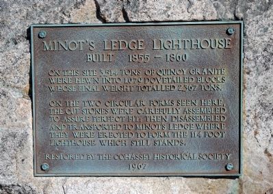
Built 1855Ė1860
On this site 3,514 tons of Quincy granite were hewn into 1,079 dovetailed blocks whose final weight totalled 2,367 tons.
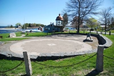
On the two circular forms seen here, the cut stones were carefully assembled to assure perfect fit; then disassembled and transported to Minotís Ledge where they were erected to form the 114 foot Lighthouse which still stands.
1967
Erected 1967 by Cohasset Historical Society.
Topics and series. This historical marker is listed in this topic list: Notable Places. In addition, it is included in the Lighthouses series list. A significant historical year for this entry is 1967.
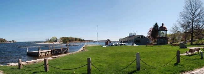
Location. 42° 14.325′ N, 70° 47.341′ W. Marker is in Cohasset, Massachusetts, in Norfolk County. Marker can be reached from Government Island Road, 0.1 miles north of Border Street, on the left when traveling north. Marker is on Government Island (now a peninsula). It is a few hundred yards from Cohasset center and can be reached by traveling east on Border Street. Immediately after crossing the bridge, turn left. Touch for map. Marker is at or near this postal address: 92 Border Street, Cohasset MA 02025, United States of America. Touch for directions.
Other nearby markers. At least 8 other markers are within 4 miles of this marker, measured as the crow flies. Antoine and Wilson Memorial (a few steps from this marker); Mordecai Lincoln Mill and Homestead (approx. 1.1 miles away); Early Boundary Line (approx. 1.1 miles away); Gannettís Corner (approx. 1.4 miles away); Lawson Tower (approx. 3.2 miles away); Cudworth House (approx. 3.2 miles away); Hull (approx. 3Ĺ miles away); Williams-Barker House (approx. 4 miles away).
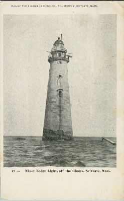
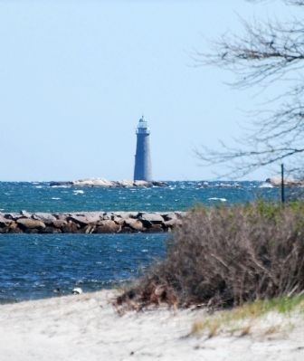
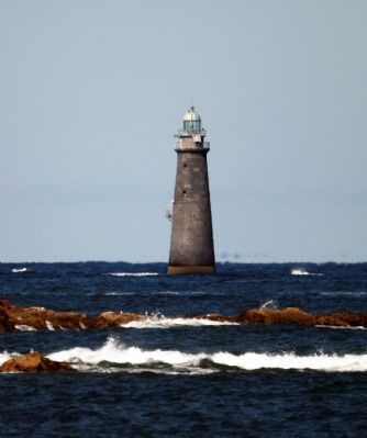
Regarding Minot's Ledge Lighthouse. The most storied lighthouse on the New England coast, the massive offshore tower was completed in 1860 to replace the first light at the same spot, which washed away in an 1851 storm (see the link, above, to the adjacent marker). As Edward Rowe Snow described the new stone structure, “The masonry was locked and dovetailed in such a way that the impact of each wave made the edifice stronger rather than weaker.”
Capt. Barton S. Alexander, United States Engineers, was superintendent for the project, using a design by Gen. Joseph G. Totten. Crews laid the first stones in July 1857, the lower half of the lighthouse being solid granite. Shortly after sunset on November 15, 1860, when Keeper Joshua Wilder officially lit the new Minotís Light for the
Photographed By Roger W. Sinnott, May 1, 2011
2. Circular Forms To Aid Assembly
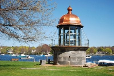
These two circular forms of paving material guided the careful fitting of massive granite stones before they were taken out to the ledge. The marker is at far left. In the background is a replica of the lamp house on Minotís Light itself.
In its first three decades Minotís Light showed a fixed beacon, leaving the possibility that a mariner might mistake it for one of the other lighthouses near Boston Harbor, with disastrous consequences. So a new lantern was installed in 1894. It flashed its own distinctive pattern in a 30-second cycle: one flash, followed by a pause, then four flashes, another pause, and then three more flashes.
There was, of course, nothing inherently romantic about Minotís Light, which has always looked forbidding, weatherbeaten, even ugly. But coastal residents soon connected the pattern of flashes with the number of letters in the expression “I love you.” The tie-in was strengthened when Alena G. Emerson, a music teacher from Boston, composed a song with these lines in about 1922:
All through the night staunch Minotís light
Flashes its signal over the sea.
To sailors it speaks of rocks and shoals
That ominous One, Four, Three.
But lovers know well that those flashes tell
The old, old story forever new,
Over and over year after year,
They read them, “I love you.”
Many times each year, seawater splashes entirely over the top of the 114-foot granite tower as waves slam against it. The tower has vibrated and trembled many times but never suffered any real damage. On one occasion the exterior ladder was broken off; on another, a pendulum clock stopped. And in the hurricane of November 1888, the keeper reported, “It leaked under the windows.”
[The above summary is based on Edward Rowe Snowís classic, The Story of Minotís Light (Halliday, 1940, 1955).]
Also see . . . Minot's Ledge Light. Wikipedia entry (Submitted on May 1, 2011, by Roger W. Sinnott of Chelmsford, Massachusetts.)
Credits. This page was last revised on October 27, 2020. It was originally submitted on May 1, 2011, by Roger W. Sinnott of Chelmsford, Massachusetts. This page has been viewed 1,127 times since then and 39 times this year. Photos: 1, 2, 3, 4, 5, 6, 7, 8. submitted on May 1, 2011, by Roger W. Sinnott of Chelmsford, Massachusetts. • Bernard Fisher was the editor who published this page.
