Marker Logo HMdb.org THE HISTORICAL
MARKER DATABASE
“Bite-Size Bits of Local, National, and Global History”
Spring Hill in Richland County, South Carolina — The American South (South Atlantic)
 

Spring Hill


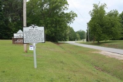
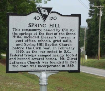
Spring Hill Marker image. Click for full size.
Photographed By Mike Stroud, May 3, 2011
1. Spring Hill Marker
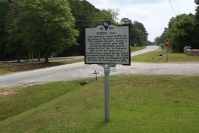
Inscription. This community, named by 1791 for the springs at the foot of the Stone Hill, included Eleazer's Tavern, a post office, schools, grist mills, and Spring Hill Baptist Church before the Civil War. In February 1865, as the war ended in S.C., Federal troops camped nearby looted and burned several homes. Mt. Olivet Lutheran Church was founded in 1873; the town was incorporated in 1889.
 
Erected 1998 by Mt. Olivet Lutheran Church. (Marker Number 40-120.)
 
Topics. This historical marker is listed in this topic list: Notable Places. A significant historical month for this entry is February 1865.
 
Location. 34° 10.387′ N, 81° 17.079′ W. Marker is in Spring Hill, South Carolina, in Richland County. Marker is on Broad River Road (U.S. 176) near Mt. Olivet Church Road (State Highway 40-2697), on the left when traveling north. Touch for map. Marker is in this post office area: Chapin SC 29036, United States of America. Touch for directions.
 
Other nearby markers. At least 8 other markers are within 8 miles of this marker, measured as the crow flies. Site of Mount Vernon Lutheran Church (approx. 1.9 miles away); Bethel Lutheran Church (approx. 2.1 miles away); Bethlehem Church (approx. 4.8 miles away); Peak (approx. 5.2 miles away); Nuclear Power (approx. 6.4 miles away); a different
Paid Advertisement
Click on the ad for more information.
Please report objectionable advertising to the Editor.
Click or scan to see
this page online
marker also named Bethlehem Church (approx. 6.9 miles away); St. Peter Church (approx. 7.3 miles away); Richlex School Site (approx. 7.3 miles away).
 
Spring Hill Marker seen looking north along Broad River Road image. Click for full size.
Photographed By Mike Stroud, May 3, 2011
2. Spring Hill Marker seen looking north along Broad River Road
Spring Hill Marker, looking south at Mt. Olivet Church Road intersection image. Click for full size.
Photographed By Mike Stroud, May 3, 2011
3. Spring Hill Marker, looking south at Mt. Olivet Church Road intersection
Spring Hill , Mt. Olivet Lutheran Church, as mentioned image. Click for full size.
Photographed By Mike Stroud, May 3, 2011
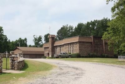
4. Spring Hill , Mt. Olivet Lutheran Church, as mentioned
Spring Hill Mt. Olivet Lutheran Church Cemetery, nearby to marker image. Click for full size.
Photographed By Mike Stroud, May 3, 2011
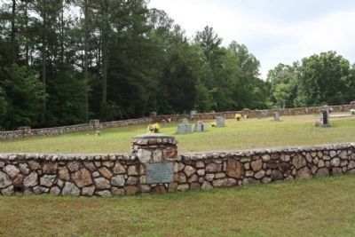
5. Spring Hill Mt. Olivet Lutheran Church Cemetery, nearby to marker
 
 
Credits. This page was last revised on June 16, 2016. It was originally submitted on May 14, 2011, by Mike Stroud of Bluffton, South Carolina. This page has been viewed 1,168 times since then and 85 times this year. Photos:   1, 2, 3, 4, 5. submitted on May 14, 2011, by Mike Stroud of Bluffton, South Carolina.
Share this page.  
Share on Tumblr
m=42379

CeraNet Cloud Computing sponsors the Historical Marker Database.
This website earns income from purchases you make after using our links to Amazon.com. We appreciate your support.
Paid Advertisement
Apr. 19, 2024