Waynesboro, Virginia — The American South (Mid-Atlantic)
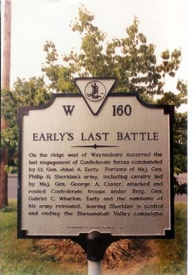
Early’s Last Battle
Erected 1989 by Department of Historic Resources. (Marker Number W-160.)
Topics and series. This historical marker is listed in this topic list: War, US Civil. In addition, it is included in the Virginia Department of Historic Resources (DHR) series list.
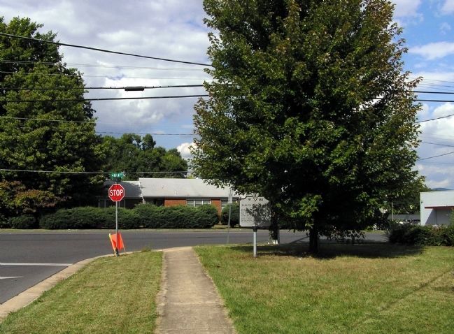
Location. 38° 4.378′ N, 78° 54.194′ W. Marker is in Waynesboro, Virginia. Marker is at the intersection of Main Street (U.S. 250) and DuPont Circle, on the right when traveling east on Main Street. Touch for map. Marker is in this post office area: Waynesboro VA 22980, United States of America. Touch for directions.
Other nearby markers. At least 8 other markers are within walking distance of this marker. Plumb House (approx. half a mile away); Wooden Water Pipe (approx. half a mile away); Fishburne Military School (approx. 0.8 miles away); Waynesboro (approx. 0.9 miles away); W. J. Loth (approx. 0.9 miles away); Rife-Loth Dam (approx. 0.9 miles away); Port Republic Road Historic District (approx. one mile away); a different marker also named Waynesboro (approx. one mile away). Touch for a list and map of all markers in Waynesboro.
Also see . . .
1. Custer and the Battle of Waynesboro. Details the actions of General Custer on the field at the Battle of Waynesboro. (Submitted on December 17, 2007, by Craig Swain of Leesburg, Virginia.)
2. Battle of Waynesboro. Short National Park Service summary of the battle. (Submitted on December 17, 2007, by Craig Swain of Leesburg, Virginia.)
Credits. This page was last revised on October 13, 2022. It was originally submitted on December 16, 2007, by Mike Stroud of Bluffton, South Carolina. This page has been viewed 2,569 times since then and 63 times this year. Last updated on October 13, 2022, by Carl Gordon Moore Jr. of North East, Maryland. Photos: 1. submitted on December 16, 2007, by Mike Stroud of Bluffton, South Carolina. 2. submitted on September 5, 2009, by PaulwC3 of Northern, Virginia. 3. submitted on September 6, 2009, by PaulwC3 of Northern, Virginia. • Bernard Fisher was the editor who published this page.


