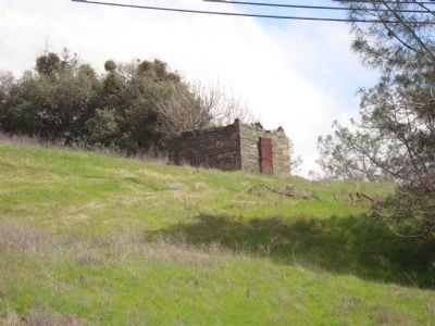
Sutter Creek in Amador County, California — The American West (Pacific Coastal)
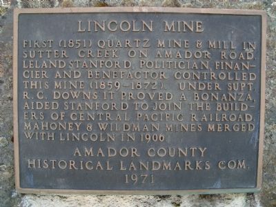
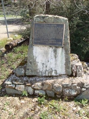
Lincoln Mine
Erected 1971 by Amador County Historical Landmarks Commission.
Topics. This historical marker is listed in these topic lists: Industry & Commerce • Natural Resources. A significant historical year for this entry is 1906.
Location. 38° 23.833′ N, 120° 48.372′ W. Marker is in Sutter Creek, California, in Amador County. Marker is at the intersection of Amador Road and Hanford Street (Old Highway 49) on Amador Road. Touch for map. Marker is in this post office area: Sutter Creek CA 95685, United States of America. Touch for directions.
Other nearby markers. At least 8 other markers are within walking distance of this marker. 135 Amelia Street (about 300 feet away, measured in a direct line); Union Mine Boarding House (about 700 feet away); a different marker also named Lincoln Mine (approx. 0.2 miles away); Mahoney Mine (approx. 0.2 miles away); Wildman Mine (approx. 0.2 miles away); Sutter Creek Jail (approx. ¼ mile away); Leland Stanford, Sr. (approx. ¼ mile away); Sutter Creek’s First Fire Bell (approx. ¼ mile away). Touch for a list and map of all markers in Sutter Creek.
Also see . . . Lincoln Mine, Sutter Creek, Amador County. Amador Gold entry (Submitted on January 7, 2021, by Larry Gertner of New York, New York.)
Credits. This page was last revised on January 7, 2021. It was originally submitted on May 14, 2011, by Barry Swackhamer of Brentwood, California. This page has been viewed 735 times since then and 27 times this year. Photos: 1, 2. submitted on May 14, 2011, by Barry Swackhamer of Brentwood, California. 3, 4, 5. submitted on July 14, 2011, by Barry Swackhamer of Brentwood, California. • Syd Whittle was the editor who published this page.
