Sealston in King George County, Virginia — The American South (Mid-Atlantic)
Stafford County / King George County
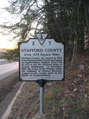
Stafford County. Area 274 Square Miles. Formed in 1664 from Westmoreland County and named for Staffordshire, England. From 1739 to 1747 it was the boyhood home of George Washington. In November 1862, the Army of the Potomac under the command of General Burnside camped in the county prior to the Battle of Fredericksburg.
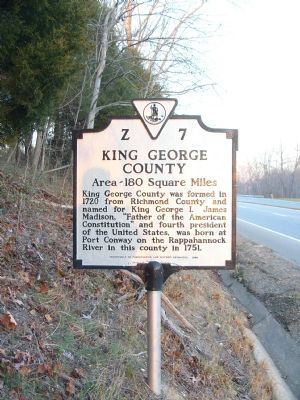
King George County. Area 180 Square Miles. King George County was formed in 1720 from Richmond County and named for King George I. James Madison, "Father of the American Constitution" and fourth president of the United States, was born at Port Conway on the Rappahannock River in this county in 1751.
Erected 1988 by Department of Convservation and Historic Resources. (Marker Number Z-7.)
Topics and series. This historical marker is listed in these topic lists: Colonial Era • Political Subdivisions • Settlements & Settlers • War, US Civil • Waterways & Vessels. In addition, it is included in the Former U.S. Presidents: #04 James Madison, and the Virginia Department of Historic Resources (DHR) series lists. A significant historical month for this entry is November 1862.
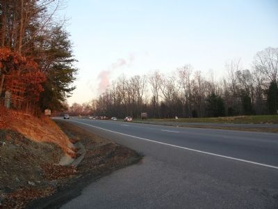
Location. 38° 15.67′ N, 77° 20.409′ W. Marker is in Sealston, Virginia , in King George County. Marker is on Kings Hwy (Virginia Route 3) near Walnut Drive, on the right when traveling west. Touch for map. Marker is in this post office area: King George VA 22485, United States of America. Touch for directions.
Other nearby markers. At least 8 other markers are within 4 miles of this marker, measured as the crow flies. Caroline County / Spotsylvania County (approx. 2.2 miles away); Bethlehem Primitive Baptist Church and Cemetery (approx. 2.4 miles away); Bethlehem Primitive Baptist Church (approx. 2.4 miles away); Jackson's Headquarters (approx. 2.9 miles away); 6th Corps Encampment (approx. 3.3 miles away); White Oak Church (approx. 3.3 miles away); White Oak Museum (approx. 3.4 miles away); The Third Lederer Expedition (approx. 3.4 miles away).
Credits. This page was last revised on July 7, 2021. It was originally submitted on December 16, 2007, by Kevin W. of Stafford, Virginia. This page has been viewed 1,252 times since then and 39 times this year. Photos: 1, 2, 3. submitted on December 16, 2007, by Kevin W. of Stafford, Virginia.


