Saint Anthony Main in Minneapolis in Hennepin County, Minnesota — The American Midwest (Upper Plains)
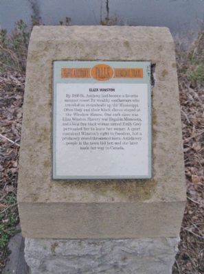
Eliza Winston
— Saint Anthony Falls Heritage Trail —
By 1860 St. Anthony had become a favorite summer resort for wealthy southerners who traveled on steamboats up the Mississippi. Often they and their black slaves stayed at the Winslow House. One such slave was Eliza Winston. Slavery was illegal in Minnesota, and a local free black woman named Emily Grey persuaded her to leave her owner. A court sustained Winston's right to freedom, but a proslavery crowd threatened harm. Antislavery people in the town hid her, and she later made her way to Canada.
Erected by the St. Anthony Falls Heritage Board.
Topics. This historical marker is listed in these topic lists: Abolition & Underground RR • Women. A significant historical year for this entry is 1860.
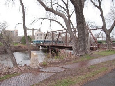
Location. 44° 59.142′ N, 93° 15.516′ W. Marker is in Minneapolis, Minnesota, in Hennepin County. It is in Saint Anthony Main. Marker can be reached from Southeast Main Street south of Merriam Street, on the right when traveling south. Marker is along a walking path next to the east channel of the Mississippi River. Touch for map. Marker is in this post office area: Minneapolis MN 55401, United States of America. Touch for directions.
Other nearby markers. At least 8 other markers are within walking distance of this marker. Symbols on the Skyline (within shouting distance of this marker); Stepping Stone Between East and West (about 400 feet away, measured in a direct line); In commemoration of the courageous French explorers (about 400 feet away); Joseph N. Nicollet (about 500 feet away); The Whirlpool (about 600 feet away); Nicollet Island Businesses (about 700 feet away); Richard Chute Square (approx. 0.2 miles away); Main Street Builds (approx. 0.2 miles away). Touch for a list and map of all markers in Minneapolis.
Also see . . .
1. Eliza Winston. Wikipedia entry. (Submitted on May 26, 2011.)
2. Merriam Street Bridge. Wikipedia entry. (Submitted on May 26, 2011.)
Credits. This page was last revised on June 26, 2023. It was originally submitted on May 26, 2011, by Keith L of Wisconsin Rapids, Wisconsin. This page has been viewed 1,349 times since then and 58 times this year. Photos: 1, 2. submitted on May 26, 2011, by Keith L of Wisconsin Rapids, Wisconsin.

