Shawsville in Montgomery County, Virginia — The American South (Mid-Atlantic)
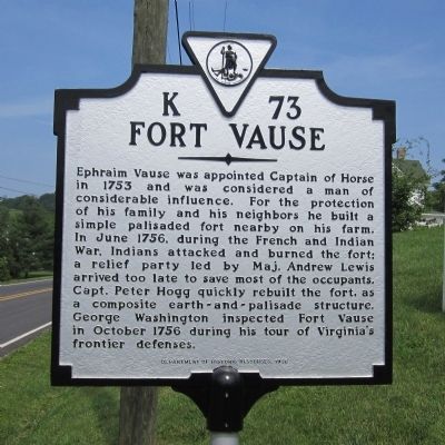
Fort Vause
Erected 1998 by Department of Historic Resources. (Marker Number K-73.)
Topics and series. This historical marker is listed in these topic lists: Colonial Era • Forts and Castles • War, French and Indian. In addition, it is included in the Virginia Department of Historic Resources (DHR) series list. A significant historical month for this entry is June 1756.
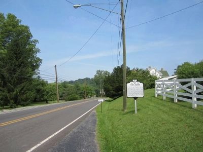
Location. 37° 10.312′ N, 80° 15.83′ W. Marker is in Shawsville, Virginia, in Montgomery County. Marker is on Oldtown Road (Virginia Route 753) east of Basham Hollow Road, on the right when traveling west. Touch for map. Marker is in this post office area: Shawsville VA 24162, United States of America. Touch for directions.
Other nearby markers. At least 8 other markers are within 9 miles of this marker, measured as the crow flies. American Revolution on the Frontier (approx. 1.2 miles away); Montgomery White Sulphur Springs (approx. 5.1 miles away); Bow String Arch Truss (approx. 5.1 miles away); The “Bowstring” Truss Bridge (approx. 5.1 miles away); Montgomery County / Roanoke County (approx. 5.8 miles away); Christiansburg (approx. 7.3 miles away); Floyd County / Roanoke County (approx. 8.1 miles away); The Oaks (approx. 8.2 miles away).
Also see . . . Fort Vause. National Register of Historic Places (Submitted on May 30, 2011.)
Credits. This page was last revised on November 10, 2021. It was originally submitted on May 30, 2011, by Bernard Fisher of Richmond, Virginia. This page has been viewed 1,562 times since then and 56 times this year. Photos: 1, 2. submitted on May 30, 2011, by Bernard Fisher of Richmond, Virginia.

