Near Blacksburg in Montgomery County, Virginia — The American South (Mid-Atlantic)
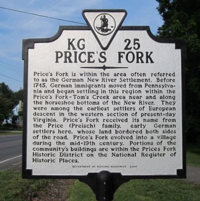
Price's Fork
Erected 2004 by Department of Historic Resources. (Marker Number KG-25.)
Topics and series. This historical marker is listed in this topic list: Settlements & Settlers. In addition, it is included in the Virginia Department of Historic Resources (DHR) series list. A significant historical year for this entry is 1745.
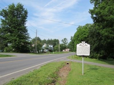
Location. 37° 12.536′ N, 80° 29.519′ W. Marker is near Blacksburg, Virginia, in Montgomery County. Marker is on Prices Fork Road (Virginia Route 685) east of Thomas Lane (Virginia Route 737), on the right when traveling west. Touch for map. Marker is in this post office area: Blacksburg VA 24060, United States of America. Touch for directions.
Other nearby markers. At least 8 other markers are within 4 miles of this marker, measured as the crow flies. Restoring Stroubles Creek (approx. 2.8 miles away); Smithfield Plantation (approx. 3.4 miles away); 1820 Slave Cabin (approx. 3.4 miles away); Slaves' Garden (approx. 3.4 miles away); Site Of The Law Offices Of Wm. Ballard Preston (approx. 3.4 miles away); Revolutionary War Patriots (approx. 3.4 miles away); Liberty and Justice for All (approx. 3.4 miles away); William Ballard Preston (approx. 3.4 miles away). Touch for a list and map of all markers in Blacksburg.
Also see . . . Prices Fork Historic District. National Register of Historic Places (Submitted on May 30, 2011.)
Credits. This page was last revised on November 10, 2021. It was originally submitted on May 30, 2011, by Bernard Fisher of Richmond, Virginia. This page has been viewed 1,465 times since then and 115 times this year. Photos: 1, 2. submitted on May 30, 2011, by Bernard Fisher of Richmond, Virginia.

