Downtown West in Minneapolis in Hennepin County, Minnesota — The American Midwest (Upper Plains)
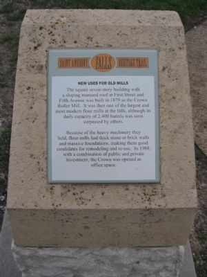
New Uses for Old Mills
— Saint Anthony Falls Heritage Trail —
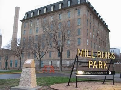
Because of the heavy machinery they held, flour mills had thick stone or brick walls and massive foundations, making them good candidates for remodeling and re-use. In 1988, with a combination of public and private investment, the Crown was opened as office space.
Erected by the St. Anthony Falls Heritage Board.
Topics. This historical marker is listed in this topic list: Industry & Commerce. A significant historical year for this entry is 1879.
Location. 44° 58.867′ N, 93° 15.578′ W. Marker is in Minneapolis, Minnesota, in Hennepin County. It is in Downtown West. Marker is on West River Parkway, 0.1 miles west of Portland Avenue South, on the right when traveling west. Marker is along a walking path at Mill Ruins Park. Touch for map. Marker is in this post office area: Minneapolis MN 55401, United States of America. Touch for directions.
Other nearby markers. At least 8 other markers are within walking distance of this marker. Giants in the Land: The Power of Minneapolis Mills and Millers (within shouting distance of this marker); Stone Arch Bridge (within shouting distance of this marker); Historic Milling District (about 300 feet away, measured in a direct line); The Washburn and Pillsbury Clans (about 400 feet away); Mills and Millraces (about 400 feet away); Bricks and Mortar (about 400 feet away); The Falls of St. Anthony (about 400 feet away); Water: The waterpower harnessed from St. Anthony Falls gave life to the milling industry (about 400 feet away). Touch for a list and map of all markers in Minneapolis.
Also see . . .
1. Crown Roller Mill, Minneapolis Minnesota. History and 1985 photos of the mill. (Submitted on June 1, 2011.)
2. Crown Roller Mill. Library of Congress. History and 1985 photos of the mill. (Submitted on June 1, 2011.)
3. Crown Roller Mill - 2007. 2007 Wikipedia photo. (Submitted on June 1, 2011.)
Credits. This page was last revised on April 24, 2024. It was originally submitted on June 1, 2011, by Keith L of Wisconsin Rapids, Wisconsin. This page has been viewed 753 times since then and 21 times this year. Photos: 1, 2. submitted on June 1, 2011, by Keith L of Wisconsin Rapids, Wisconsin.

