Near Menomonie in Dunn County, Wisconsin — The American Midwest (Great Lakes)
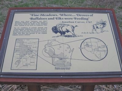
Fine Meadows
Where... Droves of Buffaloes and Elks were Feeding
— Jonathan Carver, 1767 —
Where were these "Buffaloes and Elks?" Wyoming? Montana? No, they were feeding in the prairies along the banks of the Chippewa River, roaming as far north as Chippewa Falls.
The dry conditions of prairies allowed only certain grasses, wildflowers, and a few shrubs to prosper. With very few trees for farmers to cut, the prairies were quickly converted to cropland. Today, less than one percent of the original tallgrass prairie remains!
[map] Shaded areas indicate original prairie areas.
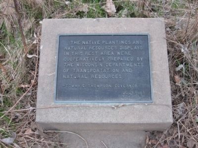
Erected 1988 by the Wisconsin Departments of Transportation and Natural Resources.
Topics. This historical marker is listed in these topic lists: Animals • Environment.
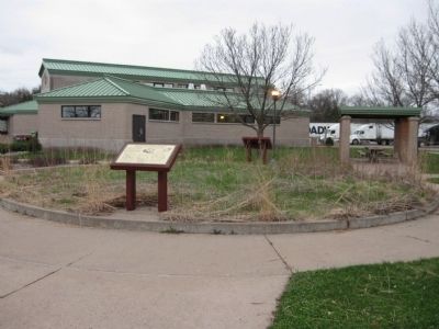
Location. 44° 54.504′ N, 91° 54.505′ W. Marker is near Menomonie, Wisconsin, in Dunn County. Marker can be reached from Interstate 94 at milepost 43,, 2.6 miles west of County Highway B, on the right when traveling west. Marker is at Rest Area 62. Touch for map. Marker is in this post office area: Menomonie WI 54751, United States of America. Touch for directions.
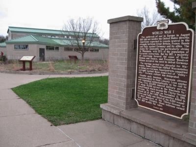
Other nearby markers. At least 8 other markers are within 3 miles of this marker, measured as the crow flies. World War I (within shouting distance of this marker); Wisconsin's Oak Savanna (about 600 feet away, measured in a direct line); a different marker also named Fine Meadows (about 600 feet away); Dunn County Veterans Memorial (about 600 feet away); Chippewa Valley White Pine (about 700 feet away); Dr. Stephen Tainter (approx. 1.4 miles away); Evergreen Cemetery / Earliest Evergreen Burials (approx. 1.4 miles away); Stori House (approx. 2.4 miles away). Touch for a list and map of all markers in Menomonie.
Also see . . .
1. Prairie. Wikipedia entry. (Submitted on June 3, 2011.)
2. 60 years after pioneering survey, Wisconsin prairies are changing rapidly. UW–Madison website entry (2016) (Submitted on November 12, 2023, by Larry Gertner of New York, New York.)
Photographed By Keith L, April 27, 2011
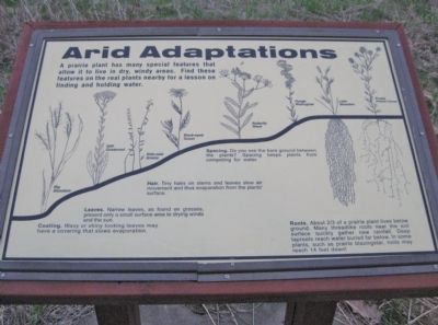
5. Arid Adaptations
A prairie plant has many special features that allow it to live in dry, windy areas. Find these features on the real plants nearby for a lesson on finding and holding water.
Big Bluestem · Stiff Goldenrod · Side-oats Grama · Black-eyed Susan · Butterfly Weed · Rough Blazingstar · Little Bluestem · Purple Prairie Clover
Coating. Waxy or shiny looking leaves may have a covering that slows evaporation.
Leaves. Narrow leaves, as found on grasses, present only a small surface area to drying winds and the sun.
Hair. Tiny hairs on stems and leaves slow air movement and thus evaporation from the plants' surface.
Spacing. Do you see the bare ground between the plants? Spacing keeps plants from competing for water.
Roots. About 2/3 of a prairie plant lives below ground. Many threadlike roots near the soil surface quickly gather new rainfall. Deep taproots reach water buried far below. In some plants, such as prairie blazingstar, roots may reach 14 feet down!
Credits. This page was last revised on November 12, 2023. It was originally submitted on June 3, 2011, by Keith L of Wisconsin Rapids, Wisconsin. This page has been viewed 445 times since then and 16 times this year. Photos: 1, 2, 3, 4, 5. submitted on June 3, 2011, by Keith L of Wisconsin Rapids, Wisconsin.
