Kansas City in Platte County, Missouri — The American Midwest (Upper Plains)
Hale: The Firepole
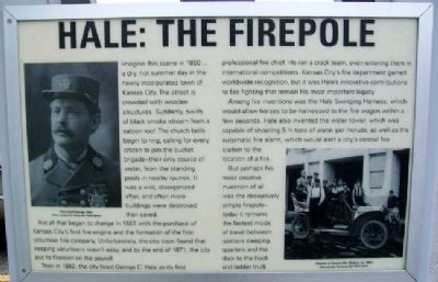
Imagine this scene in 1850… a dry, hot summer day in the newly incorporated town of Kansas City. The street is crowded with wooden structures. Suddenly, swirls of black smoke stream from a saloon roof. The church bells begin to ring, calling for every citizen to join the bucket brigade – their only source of water, from the standing pools in nearby ravines. It was a wild, disorganized affair, and often more buildings were destroyed than saved.
But all that began to change in 1867, with the purchase of Kansas City’s first fire engine and the formation of the first volunteer fire company. Unfortunately, the city soon found that keeping volunteers wasn’t easy, and by the end of 1871, the city put its firemen on the payroll.
Then in 1882, the city hired George C. Hale as its first professional fire chief. He ran a crack team, even entering them in international competitions. Kansas City’s fire department gained worldwide recognition, but it was Hale’s innovative contributions to fire fighting that remain his most important legacy.
Among his inventions was the Hale Swinging Harness, which would allow horses to be harnessed to the fire wagon within a few seconds. Hale also invented the water tower, which was capable of shooting 5 ½ tons of water per minute; as well as the automatic fire alarm, which would alert a city’s central fire station to the location of a fire.
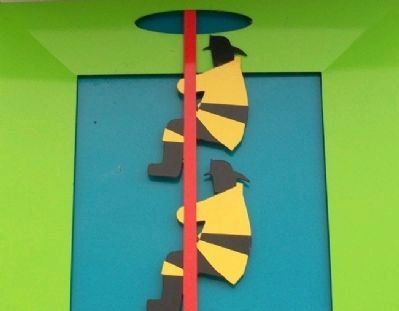
But perhaps his most creative invention of all was the deceptively simple firepole – today it remains the fastest mode of travel between upstairs sleeping quarters and the door to the hook and ladder truck.
Erected by Kansas City International Airport. (Marker Number B5.)
Topics. This historical marker is listed in these topic lists: Charity & Public Work • Roads & Vehicles. A significant historical year for this entry is 1867.
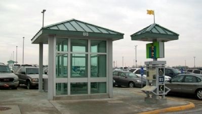
Location. 39° 18.883′ N, 94° 42.241′ W. Marker is in Kansas City, Missouri, in Platte County. Marker is at Passenger Kiosk B5, in Economy Parking Lot B, at Kansas City International Airport, 601 Brasilia Avenue. Touch for map. Marker is in this post office area: Kansas City MO 64153, United States of America. Touch for directions.
Other nearby markers. At least 8 other markers are within walking distance of this marker. The Liberty Memorial (about 400 feet away, measured in a direct line); Home of BBQ (about 400 feet away); Happy Trails (about 400 feet away); Atkins Gift (about 400 feet away); The Country Club Plaza (about 400 feet away); Tribal Heritage (about 500 feet away); KC: On Flight (about 500 feet away); Mouse Tale (about 500 feet away). Touch for a list and map of all markers in Kansas City.
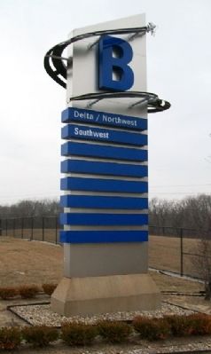
More about this marker. The Economy Parking Lots' passenger kiosks each have unique historical markers and flashy artwork to help passengers remember where they parked.
Also see . . .
1. George C. Hale. Wikipedia entry (Submitted on June 12, 2022, by Larry Gertner of New York, New York.)
2. Kansas City Fire Historical Society. Society website homepage (Submitted on June 12, 2022, by Larry Gertner of New York, New York.)
Credits. This page was last revised on June 12, 2022. It was originally submitted on June 6, 2011, by William Fischer, Jr. of Scranton, Pennsylvania. This page has been viewed 724 times since then and 28 times this year. Photos: 1, 2, 3, 4. submitted on June 6, 2011, by William Fischer, Jr. of Scranton, Pennsylvania.


