Monroe Township near Selinsgrove in Snyder County, Pennsylvania — The American Northeast (Mid-Atlantic)
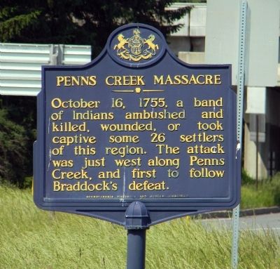
Penns Creek Massacre
Erected 1947 by Pennsylvania Historical and Museum Commission.
Topics and series. This historical marker is listed in these topic lists: Native Americans • Settlements & Settlers • War, French and Indian. In addition, it is included in the Pennsylvania Historical and Museum Commission series list. A significant historical date for this entry is October 16, 1803.
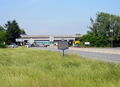
Location. 40° 49.045′ N, 76° 51.233′ W. Marker is near Selinsgrove, Pennsylvania, in Snyder County. It is in Monroe Township. Marker is at the intersection of North Market Street (U.S. 522) and Susquehanna Trail (U.S. 15), on the right when traveling south on North Market Street. The marker is between the US-15 south bound on ramp and the unbuilt south bound exit ramp. Touch for map. Marker is at or near this postal address: 357 N Market St, Selinsgrove PA 17870, United States of America. Touch for directions.
Other nearby markers. At least 8 other markers are within 2 miles of this marker, measured as the crow flies. Albany Purchase Line Stone (approx. ¼ mile away); John Harris, Founder of Harrisburg (approx. ¼ mile away); The (John) Penn's Creek Massacre (approx. ¼ mile away); Albany Purchase (approx. 0.6 miles away); “Coxey's Army” (approx. 0.6 miles away); Penns Creek Bridge (approx. 1.1 miles away); Simon Snyder (approx. 1.2 miles away); Erected to the Memory of Simon Snyder (approx. 1.4 miles away). Touch for a list and map of all markers in Selinsgrove.
Regarding Penns Creek Massacre. The body of water Penns Creek separates the town of Selinsgrove from the Susquehanna River. North of this marker it turns west into the mountains.
Related marker. Click here for another marker that is related to this marker. To better understand the relationship, study the marker shown.
Also see . . .
1. The Snyder County Post: The Penns Creek Massacre of 1755. (Submitted on June 10, 2011, by PaulwC3 of Northern, Virginia.)
2. The Paranormal Pastor - The Restless Spirits of the Penn’s Creek Massacre. (Submitted on June 10, 2011, by PaulwC3 of Northern, Virginia.)
Credits. This page was last revised on February 7, 2023. It was originally submitted on June 10, 2011, by PaulwC3 of Northern, Virginia. This page has been viewed 3,015 times since then and 100 times this year. Photos: 1, 2. submitted on June 10, 2011, by PaulwC3 of Northern, Virginia.

