Mechanicsville in Hanover County, Virginia — The American South (Mid-Atlantic)
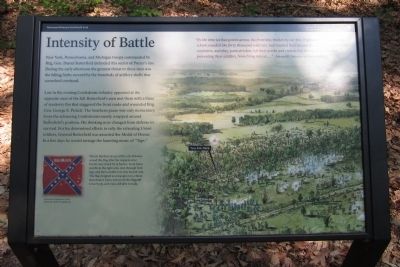
Intensity of Battle
New York, Pennsylvania, and Michigan troops commanded by Brig. Gen. Daniel Butterfield defended this sector of Porter’s line. During the early afternoon the greatest threat to these men was the falling limbs severed by the hundreds of artillery shells that screeched overhead.
Late in the evening Confederate infantry appeared at the opposite crest of the hill. Butterfield’s men met them with a blaze of musketry fire that staggered the front ranks and wounded Brig. Gen. George E. Pickett. The Southern pause was only momentary. Soon the advancing Confederates nearly wrapped around Butterfield’s position. His thinking now changed from defense to survival. For his determined efforts to rally the retreating Union soldiers, General Butterfield was awarded the Medal of Honor. In a few days he would arrange the haunting music of “Taps.”
Erected 2011 by Richmond National Battlefield Park.
Topics. This historical marker is listed in this topic list: War, US Civil.
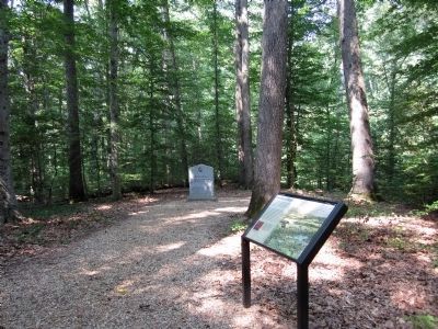
Location. 37° 34.382′ N, 77° 17.755′ W. Marker is in Mechanicsville, Virginia, in Hanover County. Marker can be reached from Watt House Road (Virginia Route 718) 0.7 miles south of Cold Harbor Road (Virginia Route 156). This marker is located in the Gaines' Mill Battlefield unit of the Richmond National Battlefield Park. Touch for map. Marker is at or near this postal address: 6283 Watt House Road, Mechanicsville VA 23111, United States of America. Touch for directions.
Other nearby markers. At least 8 other markers are within walking distance of this marker. Wilcox’s Alabama Brigade, (a few steps from this marker); Wilcox’s Brigade, CSA (a few steps from this marker); Union Rifle Pits (about 300 feet away, measured in a direct line); Morell’s Division, USA (about 300 feet away); Watt Farm Road (about 500 feet away); Mistaken Identity (about 600 feet away); Balloons Over the Battlefield (about 600 feet away); Pickett’s Brigade, CSA (about 600 feet away). Touch for a list and map of all markers in Mechanicsville.
More about this marker. On the lower left is a photo of a Confederate battle flag with the caption, "Private Banbury Jones of the 11th Alabama seized this flag after the original color bearer was struck by 13 bullets. Soon Jones was hit in the right arm, shot through both legs, and then a bullet tore into his left arm. The flag dropped and was given to a third man despite Jones’ plea to tie the flagstaff to his body, as he was still able to walk." From the Collections of the Museum of the Confederacy
Also see . . .
1. Richmond National Battlefield Park. (Submitted on June 12, 2011, by Bernard Fisher of Richmond, Virginia.)
2. Gaines’ Mill. CWSAC Battle Summary (Submitted on June 12, 2011, by Bernard Fisher of Richmond, Virginia.)
3. The Battle of Gaines' Mill. Civil War Trust (Submitted on June 13, 2011, by Bernard Fisher of Richmond, Virginia.)
Credits. This page was last revised on June 16, 2016. It was originally submitted on June 12, 2011, by Bernard Fisher of Richmond, Virginia. This page has been viewed 726 times since then and 12 times this year. Photos: 1, 2. submitted on June 12, 2011, by Bernard Fisher of Richmond, Virginia.

