North Olmsted in Cuyahoga County, Ohio — The American Midwest (Great Lakes)
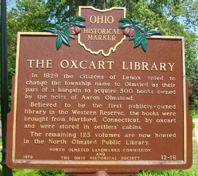
The Oxcart Library
In 1829 the citizens of Lenox voted to change the township name to Olmsted as their part of a bargain to acquire 500 books owned by the heirs of Aaron Olmsted.
Believed to be the first publicly-owned library in the Western Reserve, the books were brought from Hartford, Connecticut, by oxcart and were stored in settlers' cabins.
The remaining 125 volumes are now housed in the North Olmsted Public Library.
Erected 1979 by North Olmsted Landmarks Commission and The Ohio Historical Society. (Marker Number 12-18.)
Topics and series. This historical marker is listed in these topic lists: Charity & Public Work • Education • Settlements & Settlers. In addition, it is included in the Ohio Historical Society / The Ohio History Connection series list. A significant historical year for this entry is 1829.
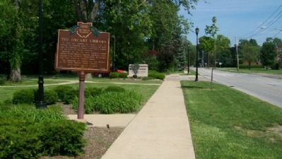
Location. 41° 24.733′ N, 81° 55.546′ W. Marker is in North Olmsted, Ohio, in Cuyahoga County. Marker is on Butternut Ridge Road, on the left when traveling east. Marker is near the Butternut Ridge Road entrance to the North Olmsted Branch of the Cuyahoga County Public Library. Touch for map. Marker is at or near this postal address: 27403 Lorain Road, North Olmsted OH 44070, United States of America. Touch for directions.
Other nearby markers. At least 8 other markers are within 2 miles of this marker, measured as the crow flies . First Universalist Church (approx. 0.3 miles away); North Olmsted Veterans Plaza (approx. 0.4 miles away); Springvale Ballroom (approx. 0.9 miles away); Butternut Ridge Cemetery 1835 (approx. 1.1 miles away); North Olmsted (approx. 1.3 miles away); Leverett Johnson / Evergreen Cemetery (approx. 1.6 miles away); Frostville Post Office / Frostville Museum (approx. 1.9 miles away); Olmsted’s Origins / Olmsted Township (approx. 2 miles away). Touch for a list and map of all markers in North Olmsted.
Also see . . . The Oxcart Library. Encyclopedia of Cleveland History (Submitted on June 25, 2022, by Larry Gertner of New York, New York.)
Credits. This page was last revised on June 25, 2022. It was originally submitted on June 12, 2011, by William Fischer, Jr. of Scranton, Pennsylvania. This page has been viewed 780 times since then and 36 times this year. Photos: 1, 2. submitted on June 12, 2011, by William Fischer, Jr. of Scranton, Pennsylvania.

