Strongsville in Cuyahoga County, Ohio — The American Midwest (Great Lakes)
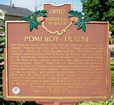
Pomeroy House
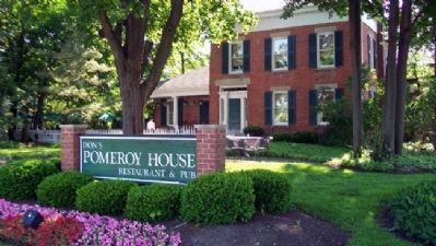
The Pomeroy House, built from 1847 to 1848, was the home of Alanson Pomeroy and his wife, Kezia. They continued the tradition, known as "Pomeroy Hospitality," that began when Alanson's parents established a tavern in Strongsville. Prominent in the community, Alanson served as township trustee and Justice of the Peace in Strongsville Township, and was a leader in the Congregational Church. Oral tradition holds that the Pomeroy House served as a stop on the Underground Railroad. Runaway slaves were brought from Oberlin, often concealed under bales of hay in wagons, and hidden in the cellar of the house until they could be safely taken to Rocky River. From there, the fugitives boarded ships headed to Canada. The Pomeroy House, listed on the National Register of Historic Places, was restored in 1979 and opened as Don's Pomeroy House restaurant in 1980.
Erected 2003 by The Ohio Bicentennial Commission, The P & G Fund, and The Ohio Historical Society. (Marker Number 48-18.)
Topics and series. This historical marker is listed in these topic lists: Abolition & Underground RR • Churches & Religion • Entertainment • Settlements & Settlers. In addition, it is included in the Ohio Historical Society / The Ohio History Connection series list. A significant historical year for this entry is 1847.
Location. 41° 18.916′ N, 81° 50.146′ W. Marker is in Strongsville, Ohio, in Cuyahoga County. Marker is at the intersection of Westwood Drive and Pearl Road (U.S. 42), on the right when traveling east on Westwood Drive. Touch for map. Marker is at or near this postal address: 13664 Pearl Road, Strongsville OH 44136, United States of America. Touch for directions.
Other nearby markers. At least 8 other markers are within 4 miles of this marker, measured as the crow flies. Town Hall and School Building (about 600 feet away, measured in a direct line); Woodvale Union Cemetery (approx. 3.1 miles away); Adams Street Cemetery (approx. 3.4 miles away); The “Big Quarry” (approx. 3.6 miles away); Berea Sandstone Quarries (approx. 3.6 miles away); The Berea Triangle (approx. 3.7 miles away); First Congregational United Church of Christ of Berea (approx. 3.7 miles away); Lyceum Square (approx. 3.7 miles away).
Also see . . .
1. History of the Pomeroy House. (Submitted on June 13, 2011, by William Fischer, Jr. of Scranton, Pennsylvania.)
2. Alanson Pomeroy. (Submitted on June 13, 2011, by William Fischer, Jr. of Scranton, Pennsylvania.)
Credits. This page was last revised on June 16, 2016. It was originally submitted on June 13, 2011, by William Fischer, Jr. of Scranton, Pennsylvania. This page has been viewed 1,530 times since then and 94 times this year. Photos: 1, 2, 3. submitted on June 13, 2011, by William Fischer, Jr. of Scranton, Pennsylvania.


