Dunstable in Middlesex County, Massachusetts — The American Northeast (New England)
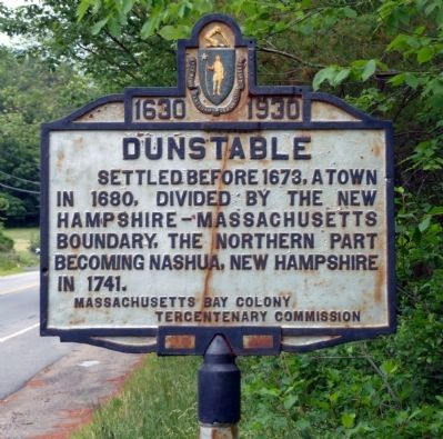
Dunstable
1630 – 1930
Settled before 1673, a town in 1680, divided by the New Hampshire – Massachusetts boundary, the northern part becoming Nashua, New Hampshire in 1741.
Erected 1930 by the Massachusetts Bay Colony Tercentenary Commission.
Topics and series. This historical marker is listed in these topic lists: Colonial Era • Settlements & Settlers. In addition, it is included in the Massachusetts Bay Colony—Tercentenary Commission Markers series list. A significant historical year for this entry is 1673.
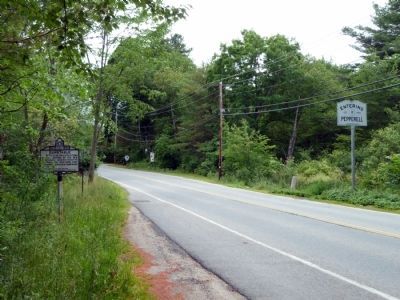
Location. 42° 40.142′ N, 71° 31.942′ W. Marker is in Dunstable, Massachusetts, in Middlesex County. Marker is on Pleasant Street (Massachusetts Route 113), on the right when traveling east. Marker is just at the town line as you leave Pepperell and enter Dunstable. Touch for map. Marker is in this post office area: Dunstable MA 01827, United States of America. Touch for directions.
Other nearby markers. At least 8 other markers are within 7 miles of this marker, measured as the crow flies. John Tinker / John Shattuck (approx. 4.2 miles away); a different marker also named Dunstable (approx. 4.3 miles away); Parker House (approx. 4.6 miles away); Groton (approx. 4.7 miles away); Mansion House (approx. 6.4 miles away); Spanish-American War Memorial (approx. 7.1 miles away in New Hampshire); World War Memorial (approx. 7.1 miles away in New Hampshire); Wannalancet (approx. 7.1 miles away).
Also see . . . Dunstable, Massachusetts. Wikipedia entry (Submitted on June 14, 2011, by Roger W. Sinnott of Chelmsford, Massachusetts.)
Credits. This page was last revised on October 26, 2021. It was originally submitted on June 14, 2011, by Roger W. Sinnott of Chelmsford, Massachusetts. This page has been viewed 598 times since then and 16 times this year. Photos: 1, 2. submitted on June 14, 2011, by Roger W. Sinnott of Chelmsford, Massachusetts. • Bill Pfingsten was the editor who published this page.

