Osawatomie in Miami County, Kansas — The American Midwest (Upper Plains)
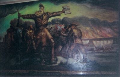
John Brown of Kansas
by
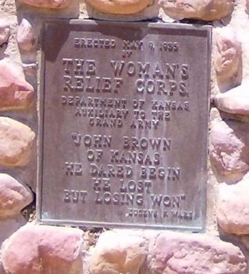
The Woman's
Relief Corps
Department of Kansas
Auxiliary to the
Grand Army
"John Brown
of Kansas
He dared begin
He lost
But losing won"
Eugene N. Ware
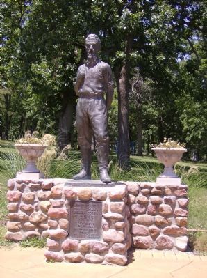
Erected 1935 by The Woman's Relief Corps, Department of Kansas (Auxiliary to the Grand Army).
Topics. This historical marker is listed in these topic lists: Abolition & Underground RR • Fraternal or Sororal Organizations • Government & Politics • Heroes • War, US Civil. A significant historical date for this entry is May 9, 1895.
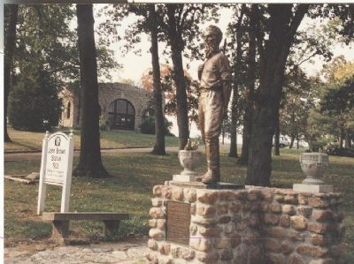
Location. 38° 29.878′ N, 94° 57.537′ W. Marker is in Osawatomie, Kansas, in Miami County. Marker is at the intersection of 10th Street and Main Street, on the right when traveling north on 10th Street. In John Brown Memorial Park. Touch for map. Marker is in this post office area: Osawatomie KS 66064, United States of America. Touch for directions.
Other nearby markers. At least 8 other markers are within walking distance of this marker. Site of the Battle of Osawatomie (within shouting distance of this marker); John Brown Battleground (within shouting distance of this marker); Battle of Osawatomie (within shouting distance of this marker); John Brown Statue (within shouting distance of this marker); a different marker also named Battle of Osawatomie (about 300 feet away, measured in a direct line); T. B. Williams and J. B. Remington (about 300 feet away); a different marker also named Battle of Osawatomie (about 400 feet away); a different marker also named Battle of Osawatomie (about 600 feet away). Touch for a list and map of all markers in Osawatomie.
Also see . . .
1. Kansas State Historical Society, John Brown State Historic Site. (Submitted on December 23, 2007, by Richard E. Miller of Oxon Hill, Maryland.)
2. John Brown's Holy War. PBS American Experience documentary about John Brown. Includes much background material. (Submitted on December 23, 2007, by Craig Swain of Leesburg, Virginia.)
3. Battle of Osawatomie. Wikipedia entry (Submitted on January 7, 2021, by Larry Gertner of New York, New York.)
Additional keywords. Bleeding Kansas
Credits. This page was last revised on January 7, 2021. It was originally submitted on December 23, 2007, by Richard E. Miller of Oxon Hill, Maryland. This page has been viewed 2,570 times since then and 17 times this year. Photos: 1, 2, 3. submitted on December 23, 2007, by Richard E. Miller of Oxon Hill, Maryland. 4. submitted on January 4, 2008, by Mike Stroud of Bluffton, South Carolina. • Craig Swain was the editor who published this page.


