Bowman in Orangeburg County, South Carolina — The American South (South Atlantic)
Bowman Rosenwald School
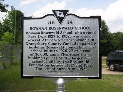
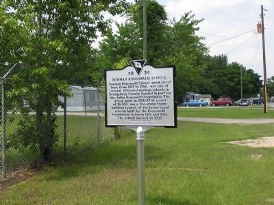
Bowman Rosenwald School, which stood here from 1927 to 1952, was one of several African-American schools in Orangeburg County funded in part by the Julius Rosenwald Foundation. The school, built in 1926-27 at a cost of $6,000, was a five-room frame building typical of the larger rural schools built by the Rosenwald Foundation between 1917 and 1932. The school burned in 1952.
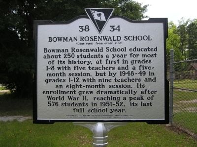
Bowman Rosenwald School educated about 250 students a year for most of its history, at first in grades 1-8 with five teachers and a five-month session, but by 1948-49 in grades 1-12 with nine teachers and an eight-month session. Its enrollment grew dramatically after World War II, reaching a peak of 576 students in 1951-52, its last full school year.
Erected 2011 by The Bowman-Rosenwald Historical Marker Committee, and the Orangeburg Chapter of the Links, Incorporated. (Marker Number 38-34.)
Topics and series. This historical marker is listed in these topic lists: African Americans • Education. In addition, it is included in the Rosenwald Schools series list. A significant historical year for this entry is 1927.
Location. 33° 20.574′ N, 80° 41.224′ W. Marker is in Bowman, South Carolina, in Orangeburg County. Marker is on Bowman Branch Hwy (State Highway 210), on the right when traveling west. Between Center Street and Adam Street on the Bowman Branch Hwy (SC 210). Touch for map. Marker is in this post office area: Bowman SC 29018, United States of America. Touch for directions.
Other nearby markers. At least 8 other markers are within 9 miles of this marker, measured as the crow flies. Bowman S.C. (approx. half a mile away); Bowman War Memorial (approx. half a mile away); Captain Richard A Morris (approx. half a mile away); Walnut Grove Church (approx. 5.7 miles away); Shady Grove Camp Ground (approx. 7 miles away); Moorefield Memorial Highway (approx. 7.8 miles away); Astronaut Frank L. Culbertson, Jr. (approx. 8.3 miles away); White House Church (approx. 8.3 miles away). Touch for a list and map of all markers in Bowman.
More about this marker. The marker is not visible when traveling east due to its distance from the road and vegetation.
Also see . . .
1. Rosenwald Schools, A National Treasure. National Trust for Historic Preservation (Submitted on June 6, 2017, by Byron Hooks of Sandy Springs, Georgia.)
2. Rosenwald School. Wikipedia (Submitted on June 6, 2017, by Byron Hooks of Sandy Springs, Georgia.)
3. Julius Rosenwald. Wikipedia (Submitted on June 6, 2017, by Byron Hooks of Sandy Springs, Georgia.)
Credits. This page was last revised on January 18, 2023. It was originally submitted on June 18, 2011, by Anna Inbody of Columbia, South Carolina. This page has been viewed 746 times since then and 27 times this year. Photos: 1, 2, 3. submitted on June 18, 2011, by Anna Inbody of Columbia, South Carolina. • Bill Pfingsten was the editor who published this page.


