Near Nokesville in Prince William County, Virginia — The American South (Mid-Atlantic)
Greenwich
Union Jack over Dixie
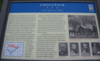
Both Union and Confederate forces passed by here several times in 1862-63. On August 27, 1862, just before the Second Battle of Manassas, Federal divisions under Gens. Jesse Reno and Isaac Stevens, as well as Col. Orlando Poe's brigade, bivouacked here. They marched to Manassas Junction the next day in pursuit of Confederate Gen. Thomas J. "Stonewall" Jackson's force.
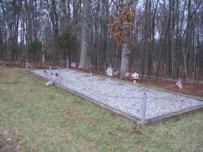
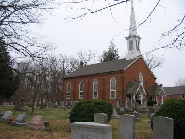
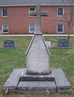
Federal cavalry chased Maj. John S. Mosby's rangers through Greenwich on May 30, 1863, after he raided Catlett Station. Mosby made a stand two miles west with a lightweight mountain howitzer but lost the cannon and several rangers including Bradford Smith Hoskins, a former British officer. Hoskins, carried to The Lawn, died of his wounds and was buried in the church cemetery.
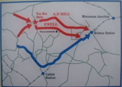
Confederate Gens. A.P. Hill and Richard S. Ewell led their corps through Greenwich on October 14, 1863, pursuing the Union army as it withdrew toward the defenses of Washington. Because Hill occupied the direct road to Bristoe Station, Ewell diverted his column to a farm road he knew well, past his childhood home, Stony Lonesome. Hill's attack on the Union rear at the station resulted in a bloody Confederate defeat.
Erected by Virginia Civil War Trails.
Topics and series. This historical marker is listed in this topic list: War, US Civil. In addition, it is included in the Virginia Civil War Trails series list. A significant historical month for this entry is May 1859.
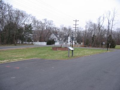
Location. 38° 45′ N, 77° 38.875′ W. Marker is near Nokesville, Virginia, in Prince William County. Marker is at the intersection of Vlint Hill Road (State Road 215) and Burwell Road (County Route 604), on the right when traveling south on Vlint Hill Road. Located in front of the Greenwich Presbyterian Church. Touch for map. Marker is in this post office area: Nokesville VA 20181, United States of America. Touch for directions.
Other nearby markers. At least 8 other markers are within 3 miles of this marker, measured as the crow flies. Stony Lonesome Farm (a few steps from this marker); a different marker also named “Greenwich” (a few steps from this marker); Vint Hill Farms Station (approx. 1.6 miles away); Grapewood Farm Engagement
Photographed By Craig Swain, December 22, 2007
2. Bristoe Station Campaign Map
Of note the base of the movements on this map (where the red and blue arrows originate), is the vicinity of Auburn, where Confederate cavalry under Gen. J.E.B. Stuart found his command between several columns of the Federal forces on the night of October 13-14, 1863. Ewell's Corps had been diverted to assist Stuart on the morning of the 14th.
More about this marker. A map on the lower left shows the movements pertaining to the Bristoe Station campaign. On the right is a photograph of Greenwich Presbyterian Church (courtesy Prince William County Public Library System, R.E.L.I.C. Room). On the lower right are portraits of Charles Green, Gen. A.P. Hill, Gen. Richard S. Ewell, and Maj. John S. Mosby.
Additional commentary.
1. Mosby's Cannon
The cannon, used with great effect during the Catlett Station raid on May 30, 1863. It was used to destroy a supply train as it arrived at the station. Then as Mosby was pressed by Federal pursuit in the withdrawal, the rifle was placed along the road on a rise where it could fire down a defile. The Federal cavalry of the 1st Vermont and 5th New York charged four times, until the gun was out of ammunition and abandoned. But the stand had enabled Mosby to escape, although suffering 20 wounded and six dead.
Hearing of the loss of the gun, balanced against the destruction of the supply train, General J.E.B. Stuart would remark that Mosby should feel welcome to sell a gun for such a high price any time.
The gun was one of a limited batch produced at Tredegar Foundry in Richmond. It was purchased by the 5th New York's post of the Grand Army of the Republic after the war. Oddly in 1872, two inches of bronze was cut off the muzzle to make a key presented to the Grand Duke Alexis of Russia. Today the old weapon resides at the 45th Infantry Division Museum in Oklahoma City, Oklahoma.
— Submitted December 23, 2007, by Craig Swain of Leesburg, Virginia.
Photographed By Craig Swain, December 22, 2007
4. Grave of Bradford Smith Hoskins
Inscription reads:
In
memory of
Bradford Smith Hoskins,
son of
the Reverend W.E. Hoskins,
Rector of Chiddingstone,
Kent, England.
Late Captain
in Her Britannic Majesty's
Fourth-Fourth Regiment.
He fell near this place
XXXI - May MOCCCLXIII
AE XXX Years
memory of
Bradford Smith Hoskins,
son of
the Reverend W.E. Hoskins,
Rector of Chiddingstone,
Kent, England.
Late Captain
in Her Britannic Majesty's
Fourth-Fourth Regiment.
He fell near this place
XXXI - May MOCCCLXIII
AE XXX Years
Photographed By Craig Swain, December 22, 2007
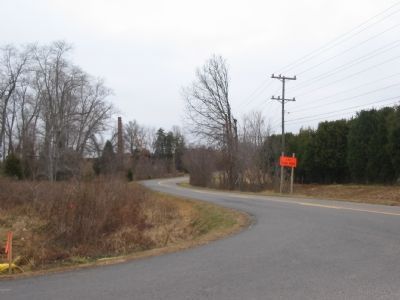
5. Mosby's Retreat from Catlett Station
Along this stretch of Rogues Road (CR 602), Mosby retreated from Catlett Station on May 30, 1863. At a rise along the road, Mosby placed his small mountain rifle and held off Federal pursuit for a time. This photo was taken from what was the rear gate to Vlint Hill Farm Station U.S. Army Base. The base has been deactivated and turned over, in part, to Fauquier County.
Credits. This page was last revised on February 26, 2021. It was originally submitted on December 23, 2007, by Craig Swain of Leesburg, Virginia. This page has been viewed 3,053 times since then and 47 times this year. Last updated on February 25, 2021, by Carl Gordon Moore Jr. of North East, Maryland. Photos: 1, 2, 3, 4, 5, 6, 7. submitted on December 23, 2007, by Craig Swain of Leesburg, Virginia. • Bernard Fisher was the editor who published this page.
