Hereford in Cochise County, Arizona — The American Mountains (Southwest)
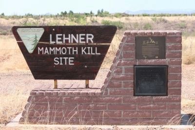
Lehner Mammoth Kill Site
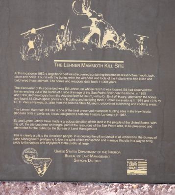
The discoverer of this bone bed was Ed Lehner, on whose ranch it was located. Ed had observed the bones eroding out of the banks of a side drainage of the San Pedro River near his home. In 1955 and 1956, archaeologists from the from the Arizona State Museum, led by Dr. Emil W. Haury, uncovered the bones and found 13 Clovis spear points and 8 cutting and scraping tools. Further excavations in 1974 and 1975 by Dr. C. Vance Haynes, Jr., also from the Arizona State Museum, uncovered butchering and cooking areas.
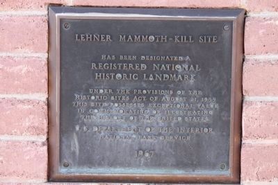
The Lehner Mammoth Kill site is one of the best preserved mammoth hunting sites in the New World. Because of its importance, it was designated a National Historic Landmark in 1967.
Ed and Lynne Lehner have made a gracious donation of this land to the people of the United State. With this gift, the site becomes an integral part of the San Pedro area, to be preserved and interpreted for the public by the Bureau of Land Management.
This is clearly a gift to the American people. In accepting the gift on behalf of all American, the Bureau of Land Management pledges to follow the spirit of this transaction and manage this site in a way to bring pride to the donors and enjoyment to the public at large.
Erected 1967 by Bureau of Land Management, U.S. Department of the Interior.
Topics and series. This historical marker is listed in these topic lists: Animals • Anthropology & Archaeology • Education. In addition, it is included in the National Historic Landmarks series list. A significant historical year for this entry is 1952.
Location. 31° 25.297′ N, 110° 6.776′ W. Marker is in Hereford, Arizona, in Cochise County. Marker is on Lehner Road, 2 miles north of Palominas Road & State Highway 92, on the left when traveling east. There is ample parking at the Monument site. Lehner Rd is a dirt road, use normal caution when traveling dirt roads. Access is limited to the monument itself and not the actual Kill site. Touch for map. Marker is in this post office area: Hereford AZ 85615, United States of America. Touch for directions.
Other nearby markers. At least 8 other markers are within 12 miles of this marker, measured as the crow flies. Mormon Battalion (approx. 3.2 miles away); Mormon Battalion Campsite (approx. 9.2 miles away); The Coronado Expedition, 1540-42 (approx. 9.8 miles away); Mule Pass (approx. 10.3 miles away); United States Border Station (approx. 11.4 miles away); Bisbee Golf Club (approx. 11˝ miles away); Copper Queen Plaza (approx. 11.8 miles away); Phelps Dodge General Office Building (approx. 11.8 miles away).
Regarding Lehner Mammoth Kill Site. An internet search will provide additional information regarding the site and other Clovis kill sites.

Photographed By James Nuti, June 20, 2011
3. Registered Historial Landmark Plaque
Has been designated a
Registered National
Historic Landmark
Under the provisions of the
Historic Sites Act of August 21, 1935.
This site possesses exceptional value
in commemorating or illistrating
the history of the United States
U.S. Department of the Interior
National Park Service
1967
Credits. This page was last revised on June 14, 2020. It was originally submitted on June 21, 2011, by James Nuti of Bisbee, Arizona. This page has been viewed 3,305 times since then and 132 times this year. Photos: 1, 2, 3. submitted on June 21, 2011, by James Nuti of Bisbee, Arizona. • Syd Whittle was the editor who published this page.
Editor’s want-list for this marker. Photos of the site and/or monument. • Can you help?

