Near Wall in Pennington County, South Dakota — The American Midwest (Upper Plains)
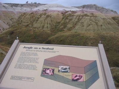
Jungle on a Seabed
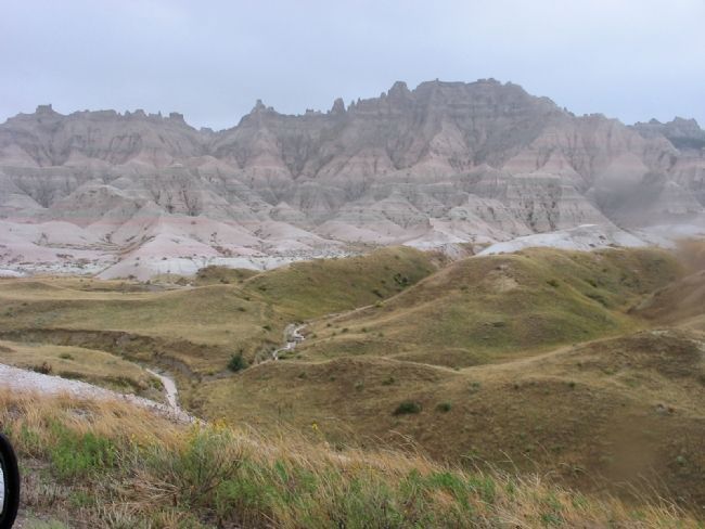
The sea's signature is ammonites, baculites, and clams, pearly fossils entombed in a fossil mud called the Pierre Shale. This shale is exposed in the gully below you.
A jungle sprang up after the sea drained away about 65 million years ago. For a long time tree roots broke up the shale, and chemicals from decaying plants produced a yellow soil. About 37 million years ago sediment from the west washed over the jungle.
The jungle rebounded, converting the new sediment into a red soil. Buried by later sediments, both yellow and red soils were fossilized. We call them the Yellow Mounds Paleosol and the Interior Paleosol.
Topics. This historical marker is listed in this topic list: Natural Features.
Location. 43° 50.606′ N, 102° 11.683′ W. Marker is near Wall, South Dakota, in Pennington County. Marker is on Badlands Loop Road (State Highway 240) 0.3 miles east of Conata Road (Road 509), on the right when traveling east. Marker is in Badlands National Park (fee to enter) at the Yellow Mounds Overlook near Dillon Pass. Touch for map. Marker is in this post office area: Wall SD 57790, United States of America. Touch for directions.
Other nearby markers. At least 8 other markers are within 11 miles of this marker, measured as the crow flies. Homesteads and Ranches (approx. 1.8 miles away); The Big Badlands (approx. 2.6 miles away); Born of Volcanos (approx. 2.7 miles away); Journey to Wounded Knee (approx. 4.8 miles away); High Security (approx. 6.3 miles away); The Carrol McDonald Post No. 246 (approx. 10.7 miles away); Reading the Rocks (approx. 10.7 miles away); It's a Dog's Life (approx. 10.7 miles away). Touch for a list and map of all markers in Wall.
Also see . . . Badlands National Park. "When the Lakota first encountered the striking, moon-like landscape, they aptly called the area “Mako Sica” or “bad land.” Early French trappers also described the area as “bad land” after difficult travels over the rugged terrain." (Submitted on December 27, 2007.)
Additional keywords. Badlands National Park
Credits. This page was last revised on June 16, 2016. It was originally submitted on December 27, 2007, by Keith L of Wisconsin Rapids, Wisconsin. This page has been viewed 2,048 times since then and 49 times this year. Photos: 1, 2, 3. submitted on December 27, 2007, by Keith L of Wisconsin Rapids, Wisconsin. 4. submitted on January 6, 2008, by Mike Stroud of Bluffton, South Carolina. • Craig Swain was the editor who published this page.


