Barnegat Light in Ocean County, New Jersey — The American Northeast (Mid-Atlantic)
Old Salty Survivors
Maritime Forest
— Coastal Habitats —
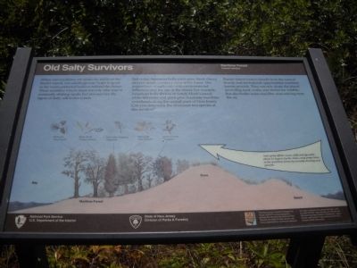
Red cedar, American holly, pitch pine, black cherry, and red maple comprise most of the forest. The proportions of each vary with environmental influences and the age of the island. For example, American holly thrives in Sandy Hook’s forest, while red cedar and pitch pine dominant maritime woodlands along the central coast of New Jersey. Can you determine the dominant tree species at this location?
Barrier island visitors benefit from the natural beauty and recreational opportunities maritime forests provide. They not only shade the island providing food, water, and shelter for wildlife, but also buffer noise and filter dust and fog from the air.
Erected by State of New Jersey Division of Parks & Forestry and National Park System.
Topics. This historical marker is listed in these topic lists: Horticulture & Forestry • Science & Medicine.
Location. 39° 45.816′ N, 74° 6.362′ W. Marker is in Barnegat Light, New Jersey , in Ocean County. Marker can be reached from Broadway, on the right when traveling north. Marker is located in Barnegat Lighthouse State Park, near the lighthouse. Touch for map. Marker is in this post office area: Barnegat Light NJ 08006, United States of America. Touch for directions.
Other nearby markers. At least 8 other markers are within walking distance of this marker. Maritime Forest Trail (a few steps from this marker); Maritime Sentinels (within shouting distance of this marker); All Shapes, Sizes and Materials (within shouting distance of this marker); Vigilant Guardian (within shouting distance of this marker); Lighthouse Keepers of Barnegat Light (within shouting distance of this marker); Massacre at Long Beach (within shouting distance of this marker); U.S. Merchant Marine WW II Memorial (within shouting distance of this marker); Maj. Gen. George Gordon Meade (within shouting distance of this marker). Touch for a list and map of all markers in Barnegat Light.
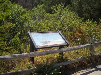
More about this marker. A picture of the Maritime Forest and its proximity to the beach, dune and bay is on the marker. The illustration explains how “Salt spray off the ocean, deflected upwards about 15 degrees by the dunes, may prune trees in the maritime forest by severely stunting new growth.”
Above this are pictures of plants that may be found in a maritime forest. These include Pitch Pine (Pinus rigida), Black cherry (Prunus serotina), Red cedar
(Juniperus virginiana), Red maple (Acer_rubrum) and American holly (Ilex opaca).
Also see . . .
1. New Jersey Coastal Heritage Trail Route. National Park Service website. (Submitted on July 1, 2011, by Bill Coughlin of Woodland Park, New Jersey.)
2. Barnegat Lighthouse State Park. New Jersey Division of Parks & Forestry website. (Submitted on July 1, 2011, by Bill Coughlin of Woodland Park, New Jersey.)
Credits. This page was last revised on June 16, 2016. It was originally submitted on July 1, 2011, by Bill Coughlin of Woodland Park, New Jersey. This page has been viewed 507 times since then and 17 times this year. Photos: 1, 2. submitted on July 1, 2011, by Bill Coughlin of Woodland Park, New Jersey.

