Plymouth in Amador County, California — The American West (Pacific Coastal)
Wheeler Building

Photographed By Barry Swackhamer, June 11, 2011
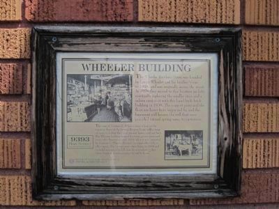
1. Wheeler Building Marker
[Lower Left Photo caption:]
The sons of Norman E. Wheeler (shown here on the wagon in front of the Levaggi Empire Store) sold a range of items including their own smoked hams cured out back. The Wheeler building housed the town grocery store and many other businesses until 1975, when it was converted by Norman V. Wheeler (Lester’s son) and wife Molly to office space. The current renovation began in 2004 and included restoring the full store front windows to face Main Street and rediscovering the red fir floors. Plymouth Economic Development Historical Sign Project
The sons of Norman E. Wheeler (shown here on the wagon in front of the Levaggi Empire Store) sold a range of items including their own smoked hams cured out back. The Wheeler building housed the town grocery store and many other businesses until 1975, when it was converted by Norman V. Wheeler (Lester’s son) and wife Molly to office space. The current renovation began in 2004 and included restoring the full store front windows to face Main Street and rediscovering the red fir floors. Plymouth Economic Development Historical Sign Project
Erected by Plymouth Economic Development Historical Sign Project.
Topics. This historical marker is listed in this topic list: Industry & Commerce. A significant historical year for this entry is 1924.
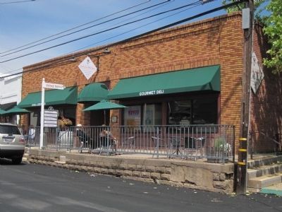
Location. 38° 28.866′ N, 120° 50.89′ W. Marker is in Plymouth, California, in Amador County. Marker is on Main Street west of California Highway 49, on the left when traveling east. Touch for map. Marker is at or near this postal address: 9393 Main Street, Plymouth CA 95669, United States of America. Touch for directions.
Other nearby markers. At least 8 other markers are within 3 miles of this marker, measured as the crow flies. The Arcade Bar (a few steps from this marker); City of Plymouth (about 300 feet away, measured in a direct line); Memorial Entrance (about 500 feet away); Chinese Store (approx. ¼ mile away); Benny Brown Arena (approx. 0.4 miles away); Plymouth Consolidated Mines (approx. 0.4 miles away); Drytown (approx. 2.7 miles away); Salute to Early Amador Miners (approx. 2.8 miles away). Touch for a list and map of all markers in Plymouth.
Credits. This page was last revised on June 16, 2016. It was originally submitted on July 4, 2011, by Barry Swackhamer of Brentwood, California. This page has been viewed 624 times since then and 32 times this year. Photos: 1, 2. submitted on July 4, 2011, by Barry Swackhamer of Brentwood, California. • Syd Whittle was the editor who published this page.
