Menominee in Menominee County, Michigan — The American Midwest (Great Lakes)
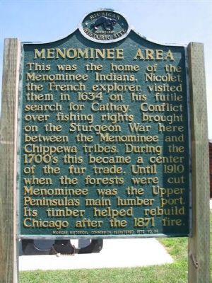
Menominee Area
Erected 1957 by Michigan Historical Commission. (Marker Number 84.)
Topics and series. This historical marker is listed in these topic lists: Industry & Commerce • Native Americans • Wars, US Indian. In addition, it is included in the Michigan Historical Commission series list. A significant historical year for this entry is 1634.
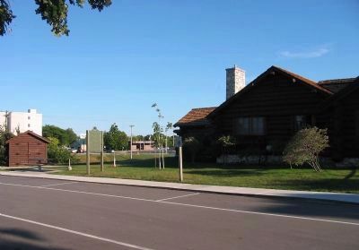
Location. 45° 6.456′ N, 87° 37.17′ W. Marker is in Menominee, Michigan, in Menominee County. Marker is on Bridge Street (U.S. 41) south of 10th Avenue, on the right when traveling north. Marker is at the Menominee Welcome Center/Claude Tobin Travel Information Center. Touch for map. Marker is in this post office area: Menominee MI 49858, United States of America. Touch for directions.
Other nearby markers. At least 8 other markers are within walking distance of this marker. Menominee County Courthouse Bell (approx. ¼ mile away); St. John the Baptist Catholic Church (approx. 0.3 miles away); Bay de Nocquet Trail (approx. 0.4 miles away); Menominee River (approx. 0.6 miles away in Wisconsin); 10,000 Board Feet of Logs (approx. 0.6 miles away in Wisconsin); Evancheck Cabin (approx. 0.7 miles away in Wisconsin); Spies Public Library (approx. 0.7 miles away); John Hubley (approx. 0.7 miles away in Wisconsin). Touch for a list and map of all markers in Menominee.
More about this marker. Cathay is the Anglicized version of "Catai" and an alternative name for China in English. -- from Wikipedia
Also see . . .
1. Menominee, Michigan. Menominee gets its name from a regional Native American tribe known as the Menominee, which roughly translates into "Wild Rice". (Submitted on December 30, 2007.)
2. The Sturgeon War. An account of the Sturgeon War can be found in A History of the Northern Peninsula of Michigan and its People by Alvah L. Sawyer (pp. 63-67). (Submitted on January 27, 2022, by Joel Seewald of Madison Heights, Michigan.)
Credits. This page was last revised on January 29, 2022. It was originally submitted on December 30, 2007, by Keith L of Wisconsin Rapids, Wisconsin. This page has been viewed 2,277 times since then and 39 times this year. Photos: 1. submitted on December 30, 2007, by Keith L of Wisconsin Rapids, Wisconsin. 2. submitted on November 12, 2008, by Keith L of Wisconsin Rapids, Wisconsin. 3. submitted on November 13, 2008, by Keith L of Wisconsin Rapids, Wisconsin. • Craig Swain was the editor who published this page.


