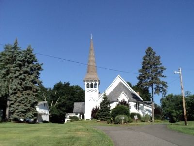
West Nyack in Rockland County, New York — The American Northeast (Mid-Atlantic)
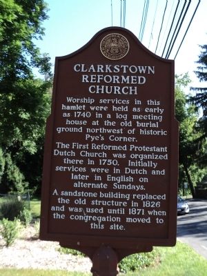
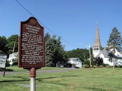
Clarkstown Reformed Church
The First Reformed Protestant Dutch Church was organized there in 1750. Initially services were in Dutch and later in English on alternate Sundays.
A sandstone building replaced the old structure in 1826 and was used until 1871 when the congregation moved to this site.
Erected by Historical Society of Rockland County.
Topics and series. This historical marker is listed in these topic lists: Churches & Religion • Colonial Era. In addition, it is included in the New York, Historical Society of Rockland County series list. A significant historical year for this entry is 1740.
Location. 41° 6.12′ N, 73° 58.355′ W. Marker is in West Nyack, New York, in Rockland County. Marker is at the intersection of Strawtown Road and Samantha Way, on the left when traveling north on Strawtown Road. Touch for map. Marker is at or near this postal address: 107 Strawtown Road, West Nyack NY 10994, United States of America. Touch for directions.
Other nearby markers. At least 8 other markers are within walking distance of this marker. West Nyack World War I Memorial (a few steps from this marker); The Old Parsonage (within shouting distance of this marker); Washington’s Encampment (about 700 feet away, measured in a direct line); Pye's Corner (about 700 feet away); Colonial Clarkstown (about 700 feet away); West Nyack's Last Horse Trough (approx. ¼ mile away); Clarksville Inn (approx. 0.6 miles away); Clarksville (approx. 0.6 miles away). Touch for a list and map of all markers in West Nyack.
Credits. This page was last revised on June 16, 2016. It was originally submitted on July 5, 2011, by Bill Coughlin of Woodland Park, New Jersey. This page has been viewed 1,401 times since then and 77 times this year. Photos: 1, 2, 3. submitted on July 5, 2011, by Bill Coughlin of Woodland Park, New Jersey. 4. submitted on April 6, 2014, by Clare Sheridan of Tappan, New York. 5. submitted on July 5, 2011, by Bill Coughlin of Woodland Park, New Jersey.
