Congers in Rockland County, New York — The American Northeast (Mid-Atlantic)
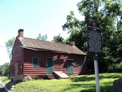
Paul Farmhouse
c. 1810
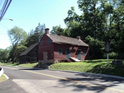
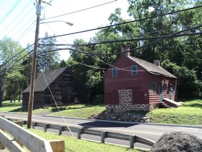
The easterly section of this Dutch farmhouse was constructed by John Paul in the early 19th Century. Soon after the similar westerly addition was added resulting in a rare style of twin front door entrances. The structure, a frame of sawn heavy timber with a clapboard and sandstone exterior, was plastered on the interior and insulated with mud and straw. Successive branches of the Paul, Jones and Schueler families lived here for approximately two centuries. Clarkstown acquired it in 1990 and restored it in 1996.
Erected 1997 by The Historical Society of Rockland County.
Topics and series. This historical marker is listed in this topic list: Notable Places. In addition, it is included in the New York, Historical Society of Rockland County series list. A significant historical year for this entry is 1990.
Location. 41° 8.173′ N, 73° 56.508′ W. Marker is in Congers, New York, in Rockland County. Marker is on Gilchrest Road north of Von Beaste Lane, on the left when traveling south. Touch for map. Marker is in this post office area: Congers NY 10920, United States of America. Touch for directions.
Other nearby markers. At least 8 other markers are within 2 miles of this marker, measured as the crow flies. Congers Lake Dam (a few steps from this marker); St. Paul’s Church (approx. 0.9 miles away); Congers Station (approx. one mile away); Congers School (approx. one mile away); Congers World War I Memorial (approx. one mile away); Kings Highway (approx. one mile away); Snedeker Farm (approx. 1.2 miles away); Doctor Davies Farm (approx. 1.4 miles away). Touch for a list and map of all markers in Congers.
Credits. This page was last revised on June 16, 2016. It was originally submitted on July 6, 2011, by Bill Coughlin of Woodland Park, New Jersey. This page has been viewed 1,131 times since then and 49 times this year. Photos: 1, 2, 3, 4. submitted on July 6, 2011, by Bill Coughlin of Woodland Park, New Jersey.


