La Vale in Allegany County, Maryland — The American Northeast (Mid-Atlantic)
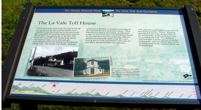
The La Vale Toll House
The Historic National Road - The Road That Built The Nation
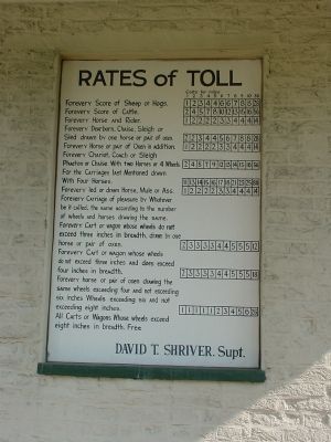
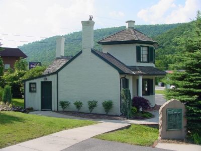
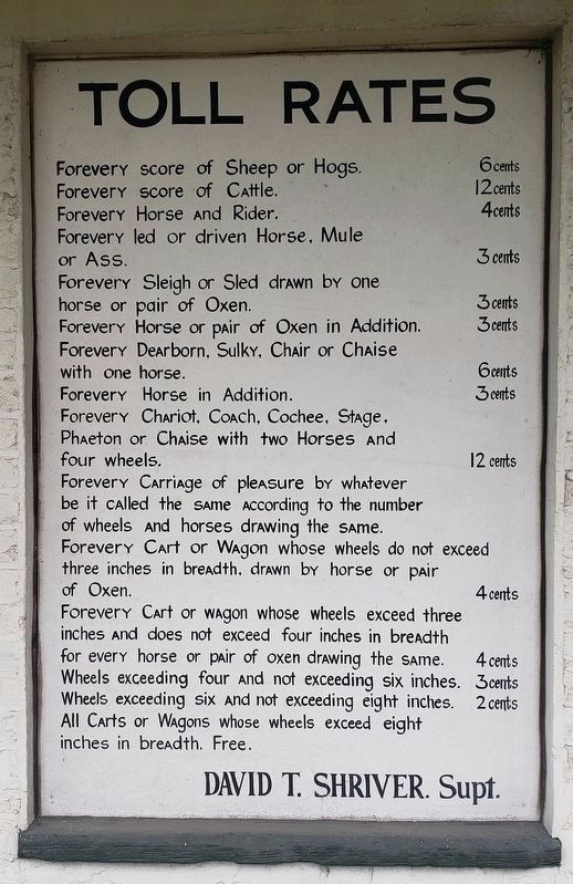
Toll houses were built along the National Road as a result of a 25 year national debate as to whether or not the federal government should be responsible for funding road improvements. While there was agreement on the idea that those who used the road should help defray maintenance costs, it was also thought unconstitutional for the federal government to charge tolls. The debate was finally resolved when it was decided to transfer ownership of the National Road to individual states. After Maryland accepted ownership, an elaborate system of rates and fares was established based on the estimated amount of damage different vehicles and animals could cause the road. During the La Vale Toll House's first year of operation, almost $10,000 was collected.
Toll collectors earned $200 a year and had free living quarters. "Pikers," travelers unwilling to pay tolls, made it difficult for toll keepers, as they tried to escape by avoiding the road. The Addison and Searights Toll Houses are of similar architecture, and can still be seen as you continue west on the National Road into Pennsylvania.
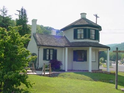
The La Vale Toll House was built to look like a gatehouse, lending it an interesting shape. The two-story brick structure has seven sides; five are equal in length while two are longer.
Topics and series. This historical marker is listed in this topic list: Roads & Vehicles. In addition, it is included in the The Historic National Road series list.
Location. This marker has been replaced by another marker nearby. It was located near 39° 38.258′ N, 78° 51.096′ W. Marker was in La Vale, Maryland, in Allegany County. Marker could be reached from National Highway SW (U.S. 40), on the left when traveling west. Touch for map. Marker was in this post office area: Cumberland MD 21502, United States of America. Touch for directions.
Other nearby markers. At least 5 other markers are within 2 miles of this location, measured as the crow flies. First Toll Gate House (a few steps from this marker); a different marker also named The La Vale Toll House (within shouting distance of this marker); "The Gateway to the West" (within shouting distance of this marker); “Spendelow Camp” (approx. 1.2 miles away); Veterans Memorial (approx. 1.4 miles away). Touch for a list and map of all markers in La Vale.
More about this marker. Another American Byways marker in "The Historic National Road — The Road that Built the Nation" series.
Regarding The La Vale Toll House. There is a small park with picnic tables at the toll house location with a little bit of parking.
Related marker. Click here for another marker that is related to this marker. This marker has been replaced with the linked marker, which has different subtitles..
Also see . . . LaVale Toll Gate House, Last Remaining in Maryland. This page has a short history, days and times it is open, and tour information. (Submitted on July 20, 2006.)
Additional commentary.
1. Text on the Daughters of the American Revolution Tablet
Dedicated to the Pioneers who with heroic sacrifice and undaunted courage blazed this old trail now known as The National Highway and thus opened "The Gateway to the West." –Erected by Cresap Chapter, Daughters of the American Revolution. Anno Domini 1931.
— Submitted July 20, 2006.
Additional keywords. LaVale Toll House, Tollhouse
Credits. This page was last revised on June 13, 2022. It was originally submitted on July 20, 2006, by J. J. Prats of Powell, Ohio. This page has been viewed 4,406 times since then and 52 times this year. Photos: 1, 2. submitted on July 20, 2006, by J. J. Prats of Powell, Ohio. 3. submitted on March 10, 2008, by Christopher Busta-Peck of Shaker Heights, Ohio. 4, 5. submitted on July 20, 2006, by J. J. Prats of Powell, Ohio. 6. submitted on May 30, 2021, by Bradley Owen of Morgantown, West Virginia.
