Marker Logo HMdb.org THE HISTORICAL
MARKER DATABASE
“Bite-Size Bits of Local, National, and Global History”
Waynesville in Warren County, Ohio — The American Midwest (Great Lakes)
 

The Bullskin Trace


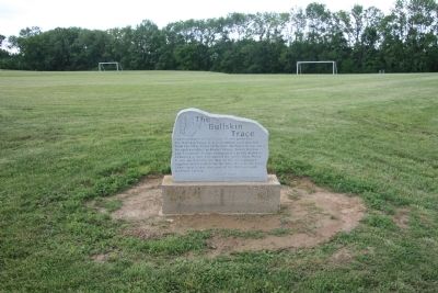
The Bullskin Trace Marker image. Click for full size.
Photographed By Dale K. Benington, June 24, 2011
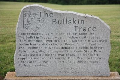
1. The Bullskin Trace Marker
Inscription. Approximately ½ mile east of this point lies The Bullskin Trace. It was an Indian trail that led from the Ohio River to Detroit, Michigan. It was used by such notables as Daniel Boone, Simon Kenton, and Tecumseh. It was designated a public highway February 4, 1807, and named the Xenia State Road. It was used during the War of 1812 to transport supplies and troops from the Ohio River to the Great Lakes area. It was also part of the Underground Railroad system.
 
Erected by Dallas R. Bogan and the Warren County Historical Society.
 
Topics. This historical marker is listed in these topic lists: Abolition & Underground RRNative AmericansRoads & VehiclesWar of 1812. A significant historical date for this entry is February 4, 1775.
 
Location. 39° 30.124′ N, 83° 59.927′ W. Marker is in Waynesville, Ohio, in Warren County. Marker is at the intersection of Miriam Lane and Cornyn Drive on Miriam Lane. This historical marker is located in Hatton Lukens Park, on the eastern edge of the community, just east of State Route 73 and off of Harveysburg Road. Touch for map. Marker is in this post office area: Waynesville OH 45068, United States of America. Touch for directions.
 
Other nearby markers. At least 8 other markers are within 7 miles of this marker, measured as the crow flies. Harveysburg / The Harveysburg School (approx. 0.4 miles away); Jonah’s Run Baptist Church / Underwood Farms Rural Historic District
Paid Advertisement
Click on the ad for more information.
Please report objectionable advertising to the Editor.
Click or scan to see
this page online
(approx. 1.1 miles away); Project History (approx. 3.3 miles away); John Evans House (approx. 5 miles away); Chester Township Veterans Memorial (approx. 5.2 miles away); Unknown Union Soldier (approx. 5.2 miles away); Friends Burial Ground (approx. 5.3 miles away); Engle Mill Road Covered Bridge (approx. 6.9 miles away). Touch for a list and map of all markers in Waynesville.
 
The Bullskin Trace Marker image. Click for full size.
Photographed By Dale K. Benington, June 24, 2011
2. The Bullskin Trace Marker
View of the historical marker on the edge of the soccer fields.
The Bullskin Trace Marker image. Click for full size.
Photographed By Dale K. Benington, June 24, 2011
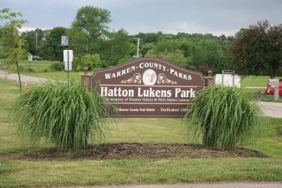
3. The Bullskin Trace Marker
View of the park sign which is where the historical marker is located.
The Bullskin Trace Marker image. Click for full size.
Photographed By Dale K. Benington, June 24, 2011
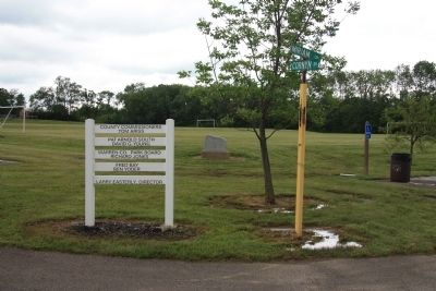
4. The Bullskin Trace Marker
Another view of the historical marker at the community recreational park.
 
 
Credits. This page was last revised on June 16, 2016. It was originally submitted on July 7, 2011, by Dale K. Benington of Toledo, Ohio. This page has been viewed 1,478 times since then and 213 times this year. Photos:   1, 2, 3, 4. submitted on July 7, 2011, by Dale K. Benington of Toledo, Ohio.
Share this page.  
Share on Tumblr
m=44321

CeraNet Cloud Computing sponsors the Historical Marker Database.
This website earns income from purchases you make after using our links to Amazon.com. We appreciate your support.
Paid Advertisement
Apr. 25, 2024