Marker Logo HMdb.org THE HISTORICAL
MARKER DATABASE
“Bite-Size Bits of Local, National, and Global History”
Near Dalton in Whitfield County, Georgia — The American South (South Atlantic)
 

Battles of Tilton

<-- 2.8 mi. --<<<


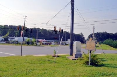
Battles of Tilton Marker image. Click for full size.
Photographed By David Seibert, July 14, 2011
1. Battles of Tilton Marker
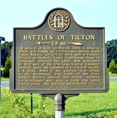
Inscription. 2.8 miles E. of here, on May 13, 1864, a delaying action was fought as Confederates moved south toward Resaca. On Oct.13, 1864, part of French’s Division of Stewart’s Corps, Confederates Army of Tennessee, attacked this place, then garrisoned by 300 men of the 17th Iowa Veteran Volunteer Infantry, under the command of Lt. Col. S.M. Archer, U.S. Army. Many of the garrison took refuge in the blockhouse just north of the town. Selden's Battery, brought into action, battered the blockhouse and, after a battle that lasted several hours, the garrison surrendered.
 
Erected 1988 by Georgia Department of Natural Resources. (Marker Number 155-33.)
 
Topics and series. This historical marker is listed in this topic list: War, US Civil. In addition, it is included in the Georgia Historical Society series list. A significant historical month for this entry is May 1852.
 
Location. 34° 39.339′ N, 84° 58.734′ W. Marker is near Dalton, Georgia, in Whitfield County. Marker is at the intersection of South Dixie Road (U.S. 41) and Carbondale Road SW, on the left when traveling north on South Dixie Road. Touch for map. Marker is in this post office area: Dalton GA 30721, United States of America. Touch for directions.
 
Other nearby markers. At least 8 other markers are within 4 miles of this marker, measured as the crow flies. The Dixie Highway Becomes Dixie Highway (approx. 1.7 miles away); The Chase, and a Battle
Paid Advertisement
Click on the ad for more information.
Please report objectionable advertising to the Editor.
Click or scan to see
this page online
(approx. 2.4 miles away); Battle of Resaca (approx. 2.8 miles away); a different marker also named Battle of Resaca (approx. 2.8 miles away); a different marker also named Battle of Resaca (approx. 3.2 miles away); a different marker also named Battle of Resaca (approx. 3½ miles away); a different marker also named Battle of Resaca (approx. 3½ miles away); Battle of Resaca, Georgia (approx. 3½ miles away). Touch for a list and map of all markers in Dalton.
 
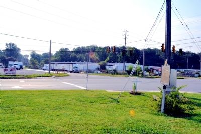
Battles of Tilton Marker image. Click for full size.
Photographed By David Seibert, July 14, 2011
2. Battles of Tilton Marker
Battles of Tilton Marker image. Click for full size.
Photographed By David Seibert, July 14, 2011
3. Battles of Tilton Marker
Looking at the intersection of South Dixie Road (US Highway 41), left, and Carbondale Road, right.
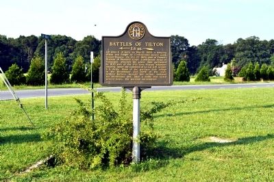
Battles of Tilton Marker image. Click for full size.
Photographed By David Seibert, July 14, 2011
4. Battles of Tilton Marker
Looking east across South Dixie Road (US Highway 41) at Tilton Road, which leads to the site of the battles.
 
 
Credits. This page was last revised on April 24, 2023. It was originally submitted on July 15, 2011, by David Seibert of Sandy Springs, Georgia. This page has been viewed 1,137 times since then and 43 times this year. Last updated on April 24, 2023, by Amanda Zimmer of Atlanta, Georgia. Photos:   1, 2, 3, 4. submitted on July 15, 2011, by David Seibert of Sandy Springs, Georgia. • J. Makali Bruton was the editor who published this page.
Share this page.  
Share on Tumblr
m=221012

CeraNet Cloud Computing sponsors the Historical Marker Database.
This website earns income from purchases you make after using our links to Amazon.com. We appreciate your support.
Paid Advertisement
Apr. 18, 2024